Introduction
Dalsland is one of my favorite places to hike in Sweden. It has several marked hiking trails (and a number of unmarked ones as well), many lakes (some massive in size), various nature reserves, and the Tresticklans National Park. It also has a low population density along with a vast amount of thick, beautiful forests, which makes for great, if not more challenging, hiking adventures in relative isolation. There are many hills and cliffs in the area, which also make this place unique, in that some routes call for scrambling and/or climbing to one extent or another.
Dalsland also features prominently in The Troll Trail, so be sure to check out that long distance route if you haven't already. If you are thru-hiking the Troll Trail, you could explore northern Dalsland as a side trail trip to extend your hike.
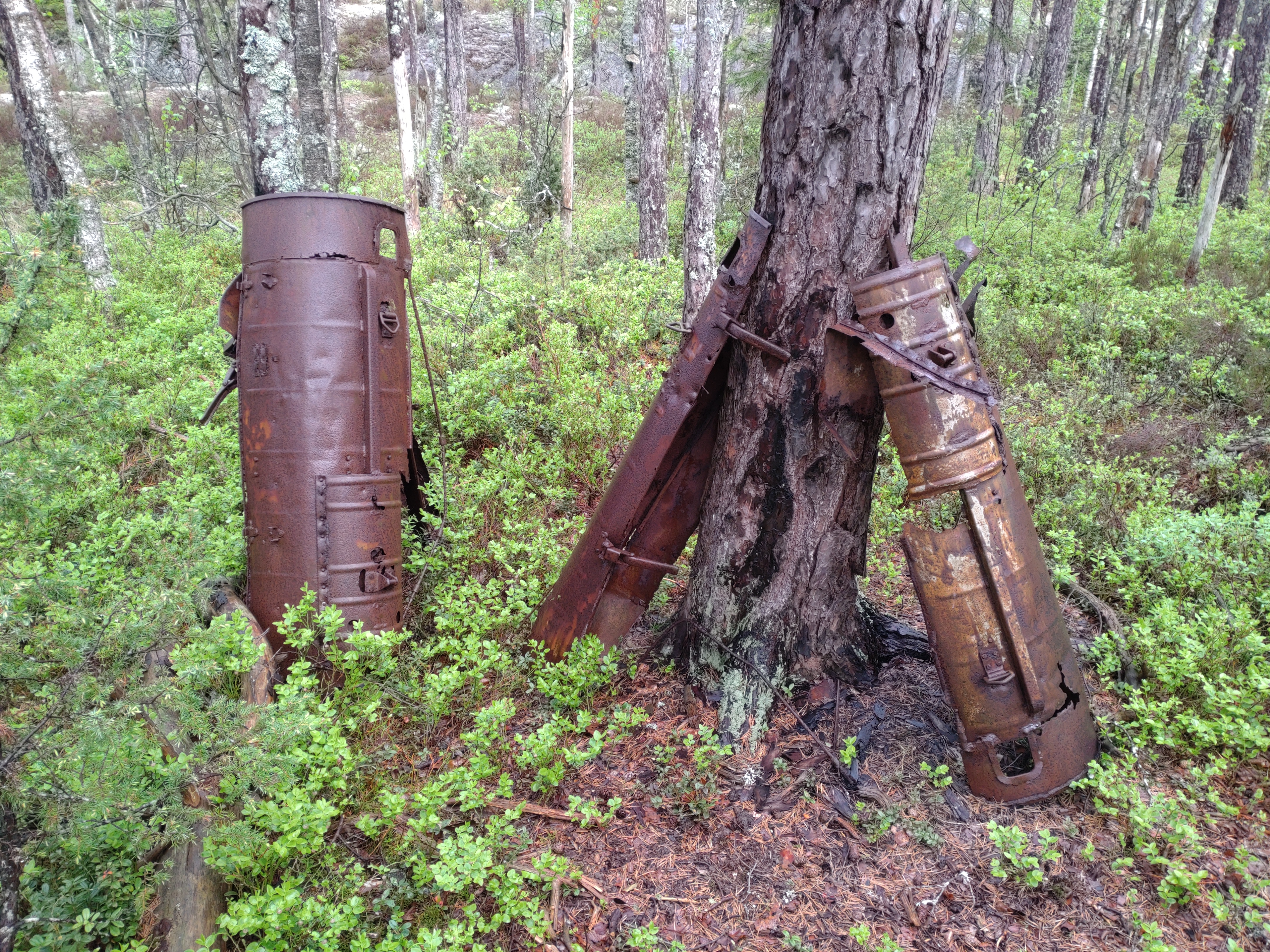
So for several years now I have hiked a fair amount of kilometers in Dalsland, yet there was one area that I've wanted to explore for a while now, and finally got the chance to go deep into this more wild northern part of the province. The plan was simple in theory: to connect the Tresticklans National Park in the northwest with the Torrskogsleden marked trail in the north. But in practice, there are various complications to account for, though I am happy to say that I feel they are definitely worth it after hiking this long-ish section hike. You'll want to spend at least 3 days or up to a week here, depending on how you choose to hike, how many kilometers you can hike in a day, and what you choose to do. There are plenty of really nice spots to swim, for example.
Here is a PDF info document (Swedish and English) with a map of Tresticklans National Park.
And here is a PDF info document (Swedish only) with a map of the Torrskogsleden hiking trail.
To hike the route detailed in the trail guide below, you will need to download a hiking terrain map for Sweden. Or you could buy or download and print physical maps. But you will definitely need good maps of this area in general, and I recommend having experience using maps on any hiking trip--but especially this route, which is a bit more challenging due to its relative isolation and its terrain. You can find my recommendations for smartphone map apps and other helpful info about hiking in Sweden if you haven't been here before in the link above to The Troll Trail.
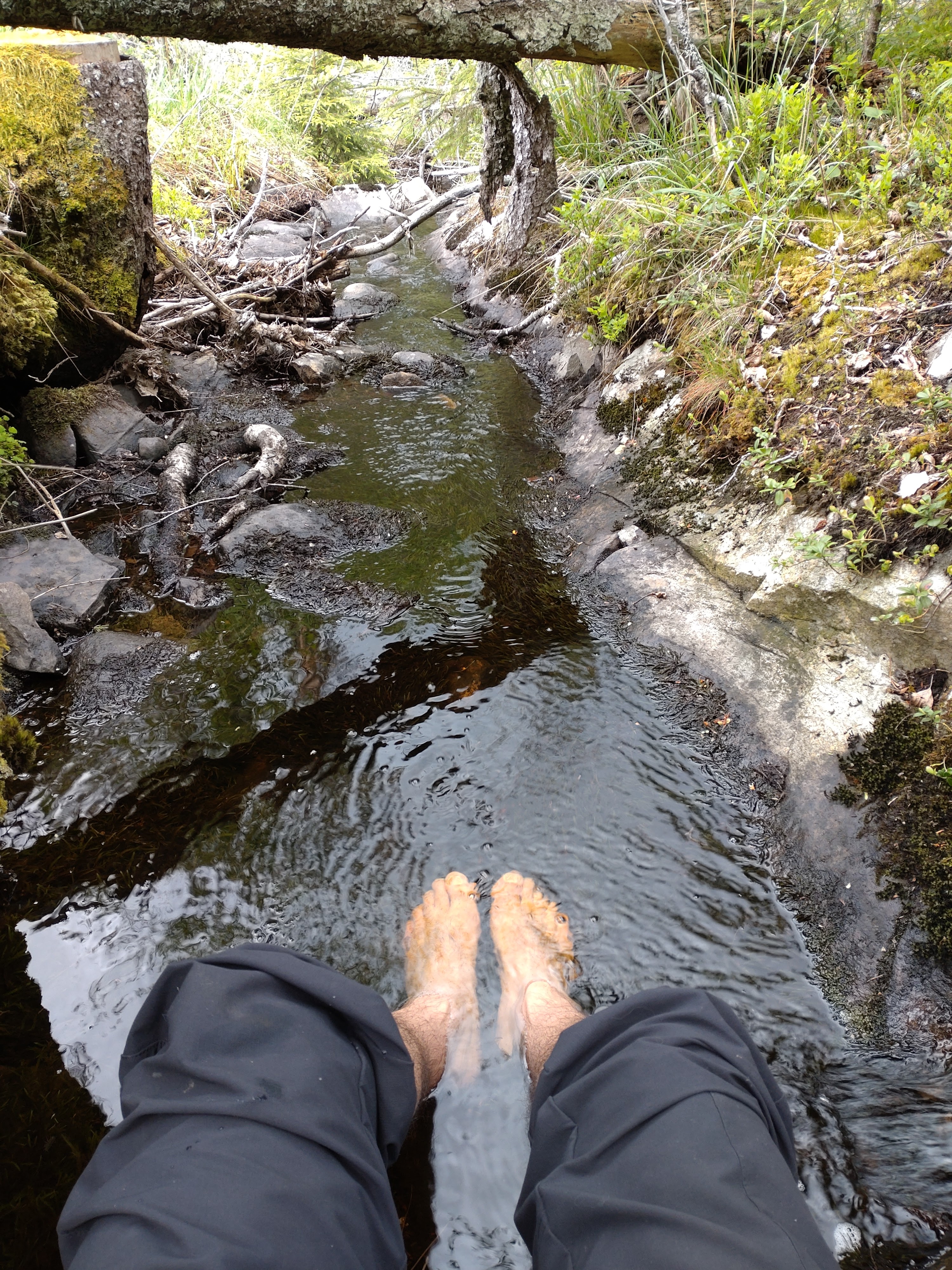
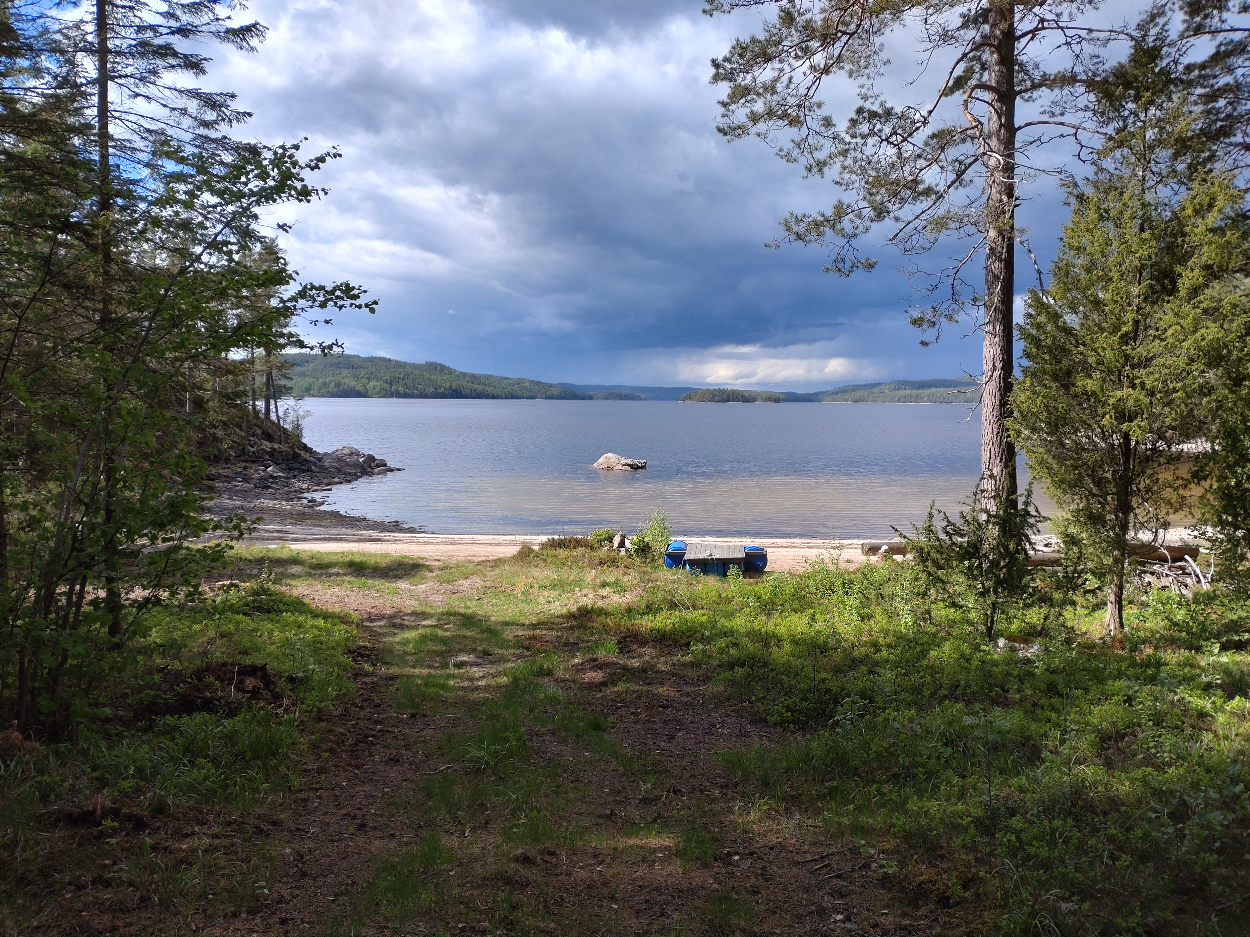
Water is abundant all over this area, and you can even be picky about your water sources and fill up at one of the many clear, cold springs that feed the lakes. Many of these springs have no homes or farms around them and are some of the better water sources I've drank from in recent memory.
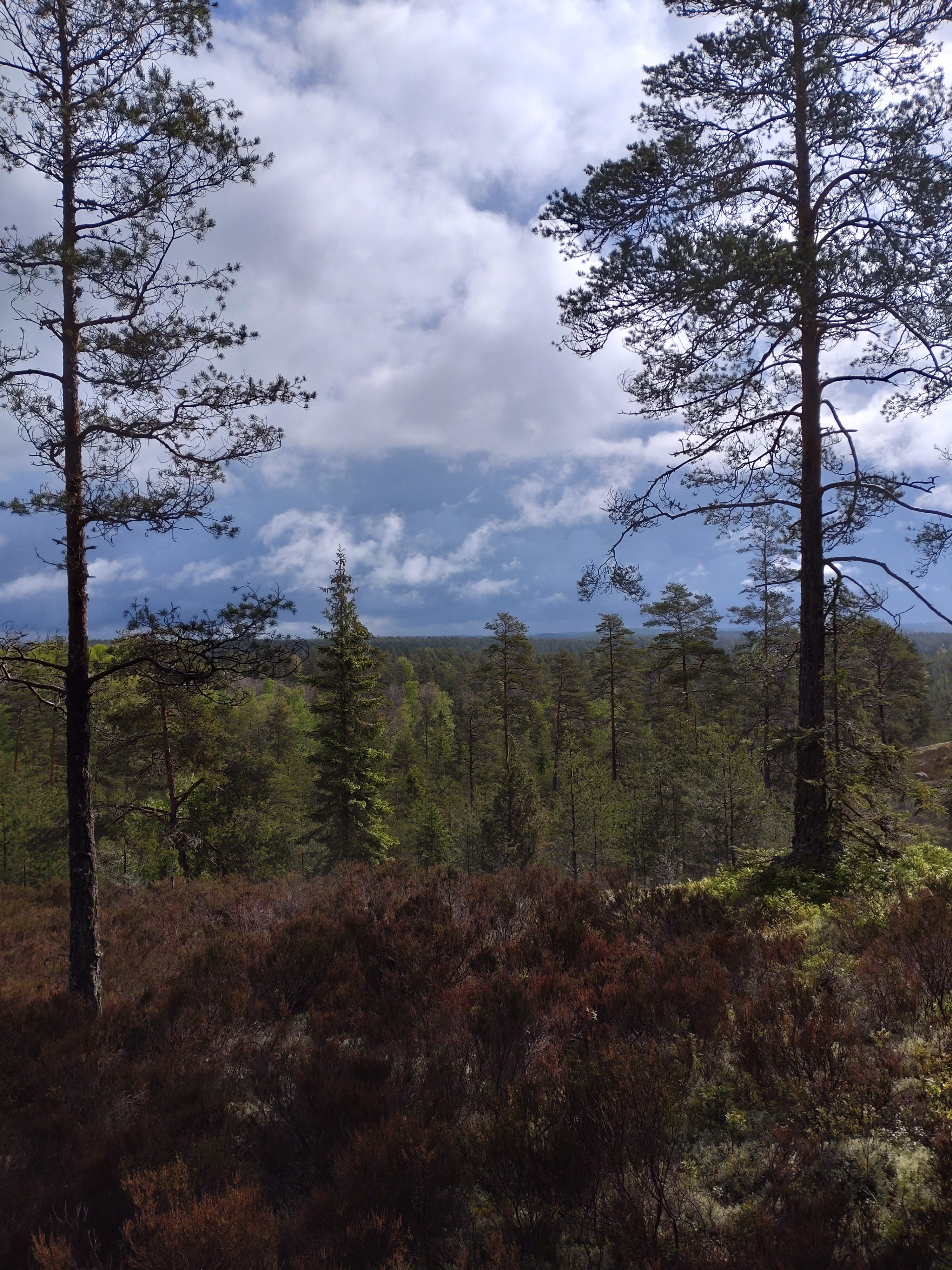
Weather can be a complication, as not only is it Sweden and chaotic in general, it's also close to the Norwegian border, which tends to send crazy weather towards Sweden due to Norway's mountains. So there can be harsh cold snaps, rain one hour and blue skies and sun the next. While I sat and ate lunch on Torrskogsleden, a dark cloud passed over me and there was a hailstorm that pounded the hill I was on for about 15 minutes. Then it turned into heavy rain for another 20 minutes, only for the cloud to pass and blue skies and bright sunlight to shine on me again. I was dry shortly after hitting the trail again after my lunch break.
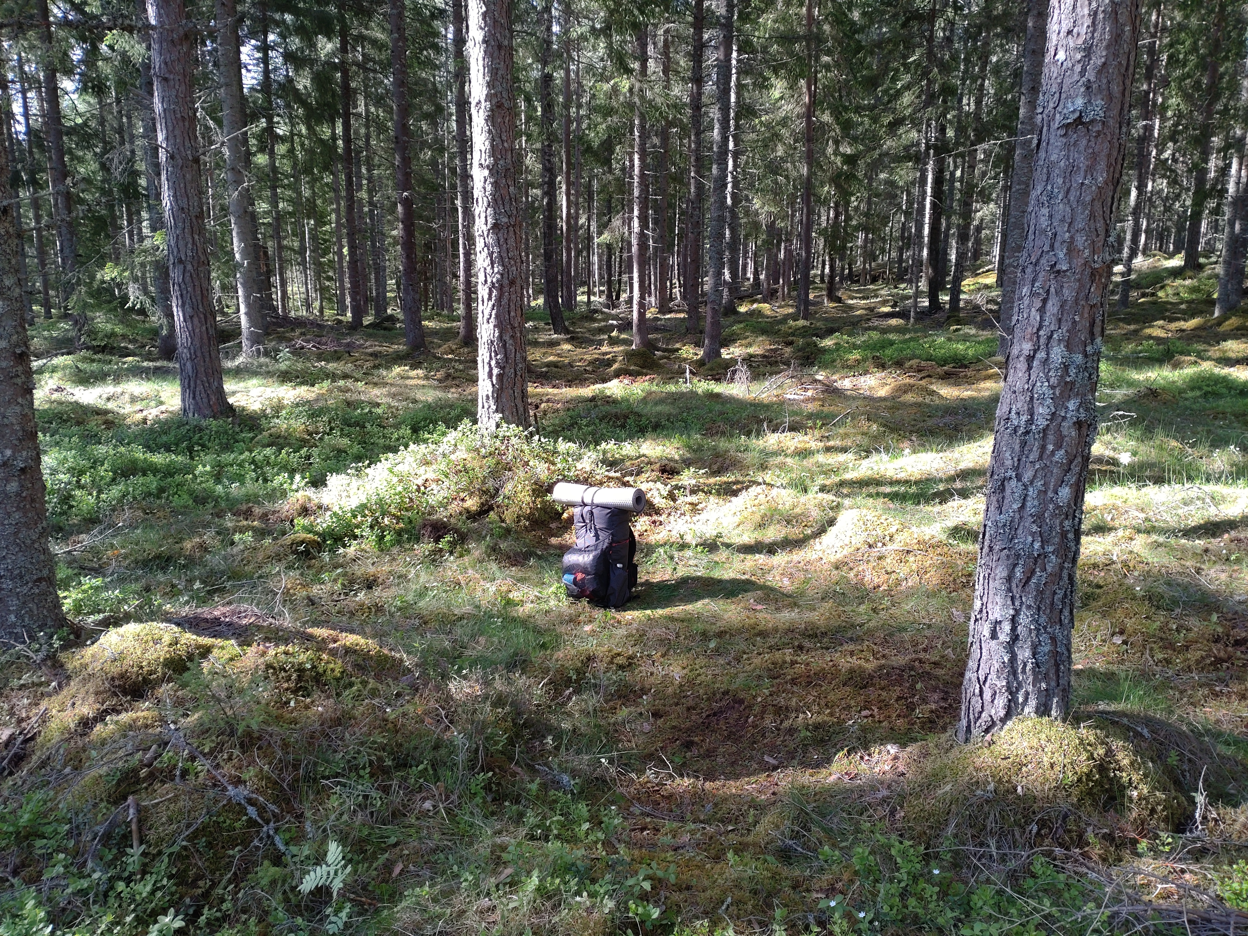
Setting up shelters can be a challenge in this area due to its terrain. It's often rocky and bumpy and uneven, and there are plenty of hills and cliffs and widow-makers around. So I suggest a shelter with a smaller footprint, and that you also make sure to scout for a campsite earlier in the evening than in flatter wilderness areas. There are a few cabins and trail shelters along the way, however, so if you plan carefully, you can spend one or more nights under a roof on this route.
Overall after many hours of planning and carefully reading maps of this area, I'm pretty happy with how this route turned out. There is some asphalt grinding to connect a few sections, but it's manageable, and there aren't many cars in this area, which makes these parts safer and more pleasant. For years I've wanted to hike Torrskogleden, but it was always out of reach due to how isolated it is. So I was excited when I finally figured out a way to connect to it, and in short it's a good little trail with a lot of character and variety. I hope that this guide can help others experience several off the beaten path locations that are beautiful and have potential for an all around excellent hiking adventure.
Trail Guide
This route can vary in distance quite a lot depending on how you go about planning it, so below are some options to consider. The small town of Ed on the southern end of lake Stora Le will be involved in one way or another, as it has a train and bus station, so it's pretty much hikers' main connection point for much of Dalsland. You can resupply in Ed and there are also a few restaurants and cafes, and there is also a convenience store and cafe in the village of Nössemark (close to where you catch the ferry on the west side of the lake).
- Hike west directly from Ed to Bastedalen in the Herådmadens nature reserve (18km) following local trails as well as doing some bushwhacking. There is an overnight cabin for hikers at Bastedalen that is quite nice. Then hike north into Tresticklans to Budalsvika (13km), where there are two trail cabins open for all hikers and one big, fancy trail cabin that is under lock and key for members of the Norwegian hiking club. Then from there follow the directions below for option #2. If I were to do this option, I would try and get to Ed as early as possible so that I could have lunch at Bastedalen and then spend the night at Budalsvika.

- Take a taxi or hitchhike from Ed to the main entrance of Tresticklans National Park. This is the option I chose for the trip report that follows below, but I have hiked the route outlined in option #1 above in the past a few times, and it's quite nice, so long as you are smart about how you bushwhack to get to Bastedalen from Ed. From the main entrance it's only a 5km hike to Budalsvika, and then another 18km to the Jaren port on the Stora Le lake. At Jaren you catch a ferry across Stora Le to the port of Sund on the eastern shores. The ferry is free of charge, and you can read more info about it on its official website (in English).
Here at Sund you must then make a choice if you want to take the easy way (10km to the trail) or the hard way (9km) to connect to Torrskogsleden. If you take the easy way, hike east to the hamlet of Sund, then hike northeast on a dirt road that will eventually connect to the trail. If you take the hard way, hike north just past the eastern port on a dirt backwoods road that dead-ends in thick woods and steep cliffs. I took the hard way on my trip, and will detail both of these paths later on. Either way, you then hike Torrskogsleden, so follow directions for option #3 below.
- Hike Torrskogsleden, which is a short (25km in total), looping, marked trail that is between lake Stora Le and another massive lake Lelång, which separates Dalsland from Värmland to the north. After hiking this trail, generally the exit strategy is to either end the trip at the bus stop near Torrskogs kyrka (a church), or hike back to the Sund port and take the ferry back to the western side of Stora Le. One could in theory hike the easy or hard way (outlined in option #2 above) to the trail, then hike the other way back so there is no backtracking to return to the ferry. More on the bus stops and other exit options later on. I was able to hike about 90% of the trail on my trip before getting a ride back to Ed close to the trail.

- Hike south back down to Ed, following a combination of dirt/gravel roads, backwoods roads, unmarked trails, and probably some more bushwhacking as well, generally following the eastern cliffs and forest of Stora Le. This would be around 30-35km from the hamlet of Sund back to Ed.


If you choose to hike all of the above options #1-4, this would result in a complete loop from Ed, around and across Stora Le, and back to Ed again, for a total of roughly 118-123km. I hiked options #2 and #3 and ended up hiking about 60km according to the step counter on my phone, but had to cut the trip short due to a minor injury on trail (I'm fine). I would recommend, and plan on hiking again in the future, options #1-3, or broken down into the following sections:
Ed to Bastedalen to Budalsvika, 31km
Budalsvika to the Stora Le Ferry to the hard way north to Torrskogsleden, 27km
Hike Torreskogsleden, looping east, then loop west to the easy way back to Sund, 30km
Take the ferry west, hike to a bus stop in the village of Nössemark, 2km
Total: 90km
The Hard Way to or from Torrskogsleden
After getting off the ferry at Sund, the first part of the hard way is actually quite pleasant and easy. You follow a backwoods dirt road north that is very scenic. There are hidden little beaches on the banks of the lake, and there is a good spring to fill up on water where the road dead ends. Past the road and the spring there are faint animal trails you can follow to continue north, but eventually you will have to find a way to climb up the cliffs in front of you. This is Sunds Branters nature reserve, though I saw no signs or any indication of any marked trails anywhere. It's just 1km from one road to another road on the other side of the cliffs, which is the goal to continue on to connect to Torrskogsleden.

But this 1km is a tough one. It took me about 45 minutes of cautious scrambling and climbing and zigzagging up and over the cliffs. But for the record I have a fair bit of experience with scrambling and climbing, and at times things were a bit sketchy. So I can't help but include a warning here to anyone thinking about taking the hard way. I do not recommend this path unless you an experienced hiker that is familiar with scrambling/climbing. And if there is bad weather, like wind, rain, or snow--even for seasoned hikers, I'd suggest being extra cautious, or perhaps avoiding the hard way altogether.
Later on in my trip report, I will of course include pictures of this section, but they don't capture all the difficulties I had. Nor would it have been wise for me to snap pictures in the middle of tricky, technical climbs. But once you eventually climb up these cliffs, there is a plateau that makes for much easier hiking for a short stretch before finding the next dirt road that heads north. This dirt road then turns east, so just follow it until you make it to the marked trail.
The Easy Way to or from Torrskogsleden
This path is pretty straightforward. Just past the hamlet of Sund head northeast on a backwoods road that turns into a trail. The trail eventually passes a cottage, then turns back into a road and intersects with a gravel road, where you turn east. Then this road intersects with a bigger gravel/dirt road where you head northeast again, passing the big farm Kölen (which should be marked on whatever map you are using). Just past the farm you should see trail markers for Torrskogsleden, and you can choose to loop east or west. But just know that if you loop west you will soon (in about 5km) pass the connection to the hard way, so it would make the most sense to hike east if you plan on hiking the hard way back to Sund later on.
Bus and Exit Strategy Complications
As I mentioned earlier, this area is pretty isolated. Which means that bus connections back to Ed from way out there are going to be tricky. There are more bus stops on the west side of Stora Le, and the buses run somewhat more regularly--twice a day rather than just once a day. There is a bus stop at Torrskog kyrka, which is close to the trailhead of Torrskogsleden, but it only runs once a day. Buses on either side of Stora Le don't run on weekends or holidays. So plan your exit strategy carefully if you are going to rely on a bus to get back to civilization. There's always hitchhiking, of course, and now that the pandemic is ending this is an option that's back on the table. But your best chance of hitching a ride is going to be at either end of the ferry ports, where cars regularly wait to ride the ferry, and this makes for a convenient spot to ask around for a ride.
There is another solution, however, but it will cost you significantly more than a bus, which is to take a taxi. I was able to book a taxi from Ed to Tresticklan, and needed to do so due to time constraints. It cost me 540 SEK, but honestly for me it was worth it because I've been dying hike in Dalsland again. And my trip did not disappoint me, until my 3rd day when I fell and hyper extended my hip. Lucky for me I was near a road (the one near the easy way path close to Kölen), and talked to a local who gave me a ride back to Ed. But I will most definitely try and do a more complete section hike and spend some more time up in northern Dalsland in the future.
Trip Report
I did this trip in late May of 2022, leaving right after work and arriving just before dusk at Tresticklans. I had heard good things about the cabins at Budalsvika, and it lived up to the hype. I have hiked Tresticklans several times before, but never made it to this border campsite, so it was great to finally spend the night there. And it was a very comfy night as well!
A stream with good water flows through the campsite, there is a nice view of a meadow on the Norwegian side, and the two trail cabins were pretty nice. One smaller cabin is close to the meadow a bit further into Norway that has a floor to crash on, but a bigger cabin with a few bunk beds is right on the border. I slept like a baby in the bigger cabin as the rain poured overnight. I'd have to hike in the rain the next morning, but I'm used to that and I was well rested and in good spirits the next day.


To exit the park hiking north I had to pay close attention to not miss the trail, as there were no signs or markers pointing out this path, but there was a clear trail to the northern end of the national park. And I did spot a few stone markers and faint, old trail markers on trees at times. This National Park is fairly popular, so I would imagine that there will eventually be a sign and/or better trail markers there in the future. At the southern end of the park, I noticed over the years that they added better trail markers and signs (for example from the park to Bastedalen) After that I followed some pleasant dirt roads before hitting the asphalt that leads to the ferry.


The ferry runs regularly during the day, but make sure to check the timetable in the link I provided above. It's a lovely little ride across the lake, and then I headed north to the hard way to Torrskogleden. Again, pictures don't do this bushwhacking justice, and I'm glad I'm not afraid of heights. But after finding the dirt road past the cliffs, it was easy to eventually get to the trail.


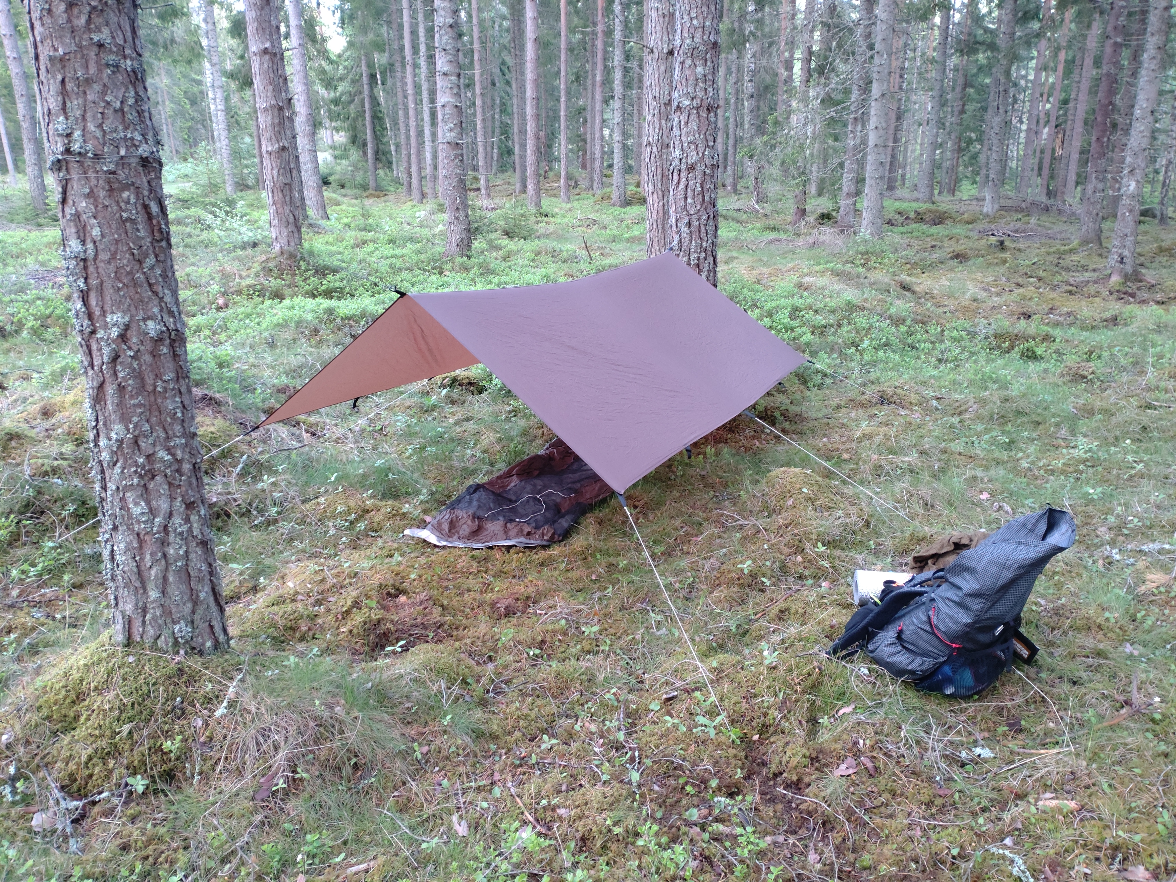
I had to really search for a flat spot to make camp in the northwestern part of the trail, but eventually found one a bit off trail, and it was nice to be back on a marked trail after doing that tough bushwhacking. And that's where this photo essay ends, doing a mostly complete loop of the trail before having to head home again. But I'm already making plans to head back up there again sometime soon.
Peace!