
----------
This post covers Stages 2 and 1, Skatås-Blåvattnerna, of the
official guide to the trail. This is the start/end point of Bohusleden in the south.
You can also check out my report on the section before this one (hiking southbound), a double report on Stages 4 and 3.
You can also check out my report on the section before this one (hiking southbound), a double report on Stages 4 and 3.
These two stages are also a part of the E1 trail system. At Skatås Stage 2 connects with the next E1 trail, Vildmarksleden, which goes east from Bohusleden to the small town of Hindås.
If you have not already read the introduction to this trail guide, you can check it out by clicking here. It has a list of reports on other sections I have hiked plus other important/useful background information in general--so please read the introduction first before reading my reports.
----------
* Another double report for two very similar sections of trail that weave around and through the city and suburbs. The very end going south or the very beginning going north, there are some nice things about Stages 2 and 1, but overall both stages (especially Stage 1) I recommend you modify how you hike them--and perhaps skip portions, or maybe even most of Stage 1. However if you are someone, say a hardcore thru-hiker, that wants to cover each and every part of the trail, I can also offer advice on how to do a more grand finish/start to the trail.
I'll cover the longer finish/start to Bohusleden first before moving on to the nuances of a slightly shorter--but what I would consider a better--version of backpacking this area. After the beginning/end of the trail in Blåvattnerna, there is another trail: the Hallandsleden. You can check out more information on this trail here.
Take the commuter train to Anneberg, which is south of Göteborg and north of the small city of Kungsbacka. Then hike for about 3.5km east on the road Älvsåkersvägen, where you will intersect with Hallandsleden, and you can make a left and hike north for a few more kilometers to Bohusleden. Or if you are hiking south and finishing Bohusleden, follow these directions in reverse to get to the train station.
Though if I were to do a thru hike of the entire Bohusleden, I would again start in the north and hike south, but rather than finish at Blåvattnerna I would finish at the lovely Gunnebo Slott (an 18th century mansion) and café. I think that this marks a much nicer end or start point of the trail. The mansion itself and the gardens are beautiful, plus there is an excellent café (albeit somewhat pricey) with good food, coffee/tea, beer, and baked goods with plenty of seating inside and outside. Makes for a good place to celebrate finishing a long hike, and only takes around 30-40 minutes to get to central Göteborg from a nearby bus stop.
After visiting the mansion, hike south on the trail again, and in no time you'll cross Pixbovägen. On this road, make a right and hike west to the bus stop Gunnebodal. From here you can take a bus to the small city of Mölndal, just south of Göteborg, where you can then take a train, tram, or another bus to many different places in town--the number 4 or 2 trams I find easiest/quickest to get into center city. Or reverse these directions if you want to start the trail at the mansion and are traveling in from Göteborg.
Now using the Gunnebo Mansion as the start/end point of the trail does skip most of Stage 1. This is not to suggest that this section is bad or anything... but I would say that one is not missing all that much in the process. Stage 1 is a nice enough hike, but for me is ultimately forgettable, especially compared with the rest of the trail. Stage 2 is a nicer hike, plus it's a shorter stage and is close to plenty of conveniences of the city--not to mention a very memorable landmark right at the beginning/end of the section.
All that being said about logistics and trip planning, let's finally move on to my last trip report and guide of this entire trail (and of course lots and lots of pics). I completed these two stages on various day hikes over the past few years. A few days ago I hiked all of Stage 2 (part of it with a few friends) and most of Stage 1, but last spring I did the last half of Stage 1, which is why the last pictures look different.
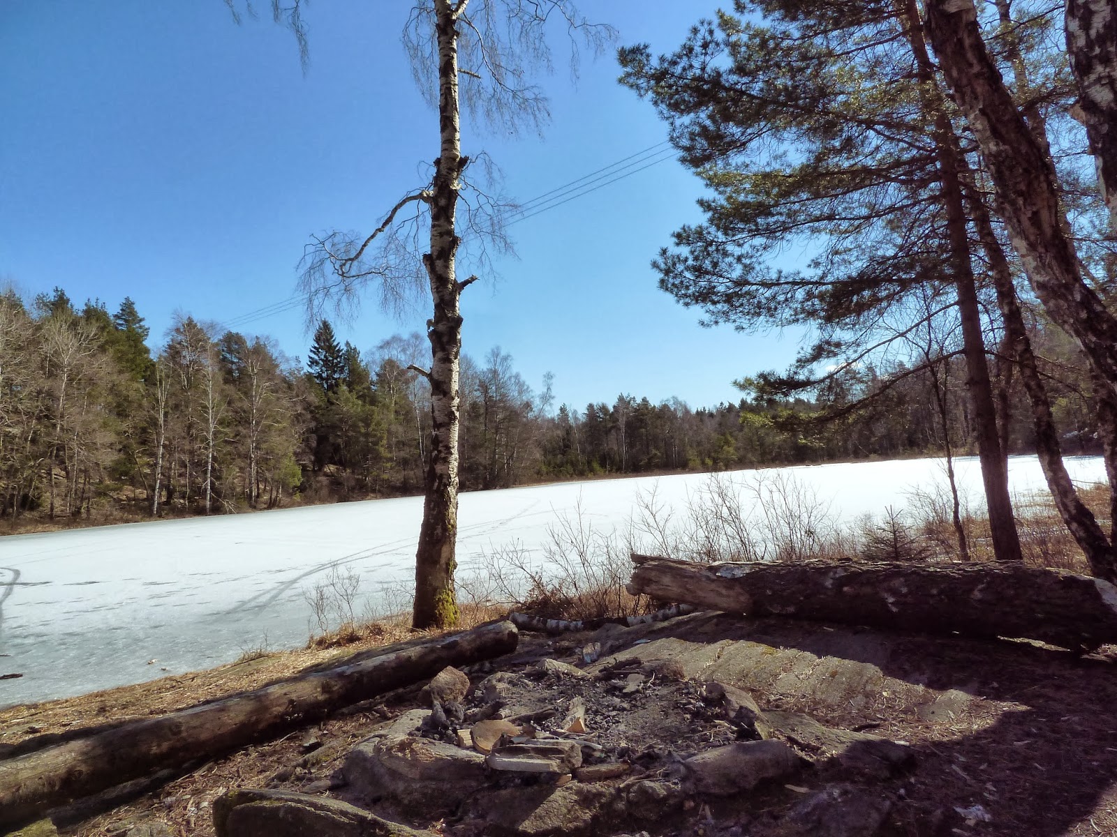
Much of Stage 2 follows the large lake St. Delsjön before crossing the 40 highway.


Around the highway there are other local trails that are nice to explore if you want. I climbed up some cliffs off trail to the west of the lake N. Långvattnet for the view, for example, before hiking back to the lake, which the trail passes right by. There is a shelter close to the south-east tip of this lake, but is more suited for breaks rather than spending the night--though in a pinch you could sleep there, I suppose.


A short woods hike and it's asphalt and houses of the suburbs as you get to the end of Stage 2. There is a bus stop--Kristinedal--that the trail passes, and you can take the 753 bus into central Göteborg from here. Going around lake Stensjön is a very well maintained path where the trail goes right by the Gunnebo Mansion, which was noted earlier. I'll let the pictures do most of the talking, but if you are looking for the café, it's the yellow building past the mansion (you'll have to get off the trail to find it).


Stage 1 begins on roads and gravel paths, and things don't resemble a nature trail until you cross the small highway. There is another break style shelter along the way, but with the mansion so close, there is little reason to hang out there. The long hike through the woods after this has several other trails around--some marked, some unmarked that only locals know.
There are a few shelters, neither of which (as you can see in the photos) are in the best condition, which is another reason that Stage 1 gets my vote to just skip. But then again, it is a pleasant enough forest to walk through, so it's up to how much time and energy you have.


After the woods trek is yet another residential, suburban walk that is pretty unspectacular. There is another lake, more suburbs, farmland, and then a golf course before you get to the last part of the trail in the small town of Lindome. There is good Thai food (made by real Thai women!) in this village, along with a supermarket and a train/bus station.
The last short stretch of trail is in the woods, however, and is fine. At the very end of the stage is the final shelter of the trail, and an anti-climactic sign that shows you the Halland/Västra Götaland boarder and end of the trail.


 |
| The end. |
Well. This is it. My last trip report of this trail. If you are interested in some final thoughts and how I would hike the trail again (and I plan on it), you can read an epilogue the guide here.