Saturday, July 6, 2019
Cesar's Guide to Glaskogen Nature Reserve
Introduction
Glaskogen is a large (240 square km) nature reserve in Sweden's Värmland county. The reserve has a variety of marked and unmarked hiking trails throughout its wilderness, as well as many backwoods dirt and/or gravel roads, lumber roads, and some normal roads as well. The reserve is also a popular destination for canoeing/kayaking and car camping due to its many lakes/ponds and rivers/streams. There are a variety of ways hikers can choose to get to Glaskogen, and the best way to think of hiking this nature reserve is to treat it as a "choose your own adventure" type experience due to its many options.
Here's its official website (in English).
This reserve is a part of my alternate Swedish E1 trail system I call The Troll Trail, which you can learn more about here. Hiking northbound, the next section is the northern part of Pilgrimsleden Värmland, which takes you to the Norwegian border and a short connection hike to Finnskogsleden (near the town of Charlottenberg). Hiking southbound, the next section is made up of various trails across Dalsland province.
There are possible connections to several towns (Årjäng, Arvika, Säffle) and even the city (and capital/largest city of Värmland) of Karlstad. The easiest way to connect to civilization is to catch a bus from highway E18 (south of the reserve) or highway 175 (east of the reserve). Be aware however that due to the relatively isolated area that this reserve is in that bus connections are few and far between and may not run on the weekends/holidays, especially along the less traveled highway 175. Hitchhiking is always an option of course, and I had good luck getting a ride all the way to Karlstad from highway E18 on a previous section hike.
The trip report that follows covers a hike from the village of Stömne--which is about 10km east outside of the reserve--to the village of Älgå, roughly 5km northeast from the reserve. This covers a total of around 80-85km (according to measurements on our smartphone's pedometers) following a mix of trails and roads, nearly hiking the whole reserve east to west, then hiking north to northeast through the northern part of the reserve. We took a bus from the town of Säffle to Stömne to enter the reserve, and ended our trip by hiking to Älgå and catching a bus to Arvika.
Regardless of how one chooses to hike Glaskogen, continuing a thru-hike on the alternate E1 is more straightforward. Going north there are two options that I would recommend, depending on whether or not you need to resupply.
If you need to resupply, hike to Älgå and then take the bus to Arvika. After resupplying and maybe taking a zero or nero day (it's a cozy little town with hotels, restaurants, etc.), you can then either take a bus back to Älgå and backtrack to the trail, or skip ahead by taking a bus to the town of Koppum. If you don't need to resupply--for example, maybe you resupplied at one of the villages on the E18 highway--then ignore Älgå and continue hiking north to the key location of the northern tip of lake Övre Gla. From this key point you can hike north on a backwoods road to exit the reserve, and conveniently this road also connects to Pilgrimsleden Värmland only 3km after leaving Glaskogen. I plan on continuing to hike northbound on this trail in the future, and will link to my guide to this section soon after.
Hiking southbound, simply find the section of Pilgrimsleden Värmland at the southern end of Glaskogen that exits the reserve and then crosses the E18 highway. You can read about my guide to this section here.
Trip Report
My wife and I hiked Glaskogen at the end of June 2019, and we agreed that it was a wonderful nature reserve that is kind of a hidden gem as far as backpacking goes. We expected not to see a ton of backpackers, but did expect to see at least a few. But we literally saw none in the four days we spent in the park. We saw more backpackers way out in the mountains further up north! We hardly saw anyone aside from the occasional car campers and canoers.
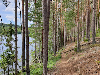
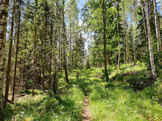
So if you are looking for a lovely hike off the beaten path that flows through a vast patch of forested hills full of lakes, rivers, streams, and springs, then Glaskogan's got it. There were times that the marked trails could have been marked better, but due to the various options of backwoods roads and unmarked trails, if you get off track it's not a big deal. We pretty much covered the full range of routes you can follow while hiking: bushwhacking, marked and unmarked trails, grassy abandoned backwoods roads, gravel/dirt roads, etc. But luckily there was very little asphalt on the path we took. If you like having lots of options and routes, this is an added bonus of hiking this reserve. If not, well then just pick a marked trail and try and stick with it, but have map and compass handy.
Close to the bus stop at Strömne there was a marked trail that we took west into Glaskogen. It was a very pleasant start to our trip, with the trail following along a river, a few lakes, and had three trail shelters before entering the reserve. Several great spots to take a swim as well.
After getting into the reserve, as mentioned before, we hiked kind of all over the place. But we stuck to our plan of generally going west to the edge of the reserve, then headed north to north by northeast. So rather than go into all the painstaking details of how we hiked through the reserve and each twist and turn, I'm going to show off a photo essay of highlights from our trip instead. Enjoy! And if you get around to hiking Glaskogen, we hope you will enjoy it as much as we did.


