

Introduction
I must admit that I am pretty excited writing this guide. For one, well the trip that it is based on went great--better than my expectations even. But also because what I am attempting to do here is effectively create an entirely new hiking loop that can be done on its own or in addition to another long hiking trail. So because of this context, this will have to be longer guide and report with lots of background information. You've been warned: big wall-o-text to follow. Otherwise just scroll down for more of the pretty pictures. Let's begin.
Dals-Ed is a municipality in south-west Sweden that boarders Norway, and has a vast amount of forests, several national parks and hiking trails, and lots of potential for great wilderness backpacking trips. One feature of this area that I personally find quite appealing and somewhat unique is its rift terrain, which has many long, tall hills/cliffs in narrow ranges throughout the landscape. Along with this interesting elevation also come many rift valleys that form plenty of lakes and tarns (often long and narrow), as well as winding rivers and streams.
I've been hiking and exploring the western parts of Dals-Ed for nearly a decade now, doing a variety of trips from off-trail bushwhacking, to following marked trails into the area--such as Bohusleden, which goes very close to the boarder of Dals-Ed at several points--to a mix of both. And I've really grown fond of this area, which is of course why I have returned so often. It's full of natural beauty, is low in population, and is hence more wild and unspoiled. Plus there always seemed like there was more to discover about this area, and this proved true on my most recent trip there.
For a long time I had wanted to go and explore the Tresticklans national park in this area, but it was logistically a bit of a challenge, as it is pretty isolated. It is also not a very large park, so I also hesitated going all the way out there only to run out of trail to hike on the first day. Then finally I sat down and worked out a plan after hours of pouring over various maps to connect this park to Bohusleden to the south, and explore more of Dals-Ed along the way. I call it The Ed Loop, and will explain in detail how it works shortly.
Here is the official Tresticklans website in English, and here is a pretty good PDF map of the park.
My inaugural trip on this loop was wonderful, and I was also happily surprised by discovering some new trails and even a whole new national park called Heråmaden. These trails and the park are not even on my detailed terrain map of the area, which is pretty recent, from 2014--and to my knowledge the most recent terrain map of the area currently available. A bit of Googling reveals that this park was founded in 2014, so looks like the map just missed it. Below is the info sign and a close up picture of the map of the park on the sign.


Heråmaden park is directly south of Tresticklans park, separated only by a gravel road, and the marked trail running through Tresticklans ends in the south at this road and a small parking lot. Then after a short (1km) hike on the road, one can then continue into Heråmaden on another trail that continues south. This trail is very new, and when I found it, the trail markings weren't even finished yet. But there was a faint trail on the ground, paper markers left on tree branches, and brand new wooden bridges and walkways built on the trail. There's even a cozy cabin in the middle of the park that the trail leads to.
South of Heråmaden there are several possibilities for hikers. There are a few small highways, where one can hike on, hitchhike, and there are also some isolated bus stops--though buses only run rarely, if at all. Yet there are also some unmarked trails and even off-trail hiking that one can do, and an alternative I found and hiked opens up several great additions/options to the well established and well known Bohusleden.
The Bohusleden Connection, and What is The Ed Loop?
For anyone that is doing a thru-hike or longer section hike of Bohusleden, the path into western Dals-Ed offers a variety of great additions to your adventure. For one, it's more off the beaten path, if you are craving more isolation and raw wilderness. It can also conveniently connect a hiker to the small town of Ed, which is roughly 10-12km to the east of the Heråmaden national park. So one could just hike to Ed following the highway, hitchhike, take a rare bus, or hike there following backwoods roads combined with a bit of off-trail trekking (more on this later).
Or around 4km from Tresticklans national park there is a small highway that one can catch a bus or taxi into town that are a bit more regular, and again hitchhiking is an option. See Västtrafik for more information, and do note that you may need to book a spot on bus or taxi van at least an hour in advance to get up to the national park. You can do this by calling Västtrafik directly.


Ed is a good place to resupply and enjoy a few backpacking luxuries. There are a few centrally located supermarkets, alcoholic beverage store (Systembolaget), a few restaurants, a café, and even an outdoor sporting goods store. There is also a bus and train station that can further connect you to many other places, such as the big city of Göteborg to the south.
For a hiker on Bohusleden going either north or south, they could do a loop to Ed and back to Bohusleden trail again, or of course choose to end their trip at Ed, or perhaps take a bus or train to another trail if they have the time. So because Ed is a goal or central part of this area, that's why I decided to simply refer to it as The Ed Loop.
*Update 01/06/2017: I recently hiked a trail that is not too far away from Ed, Pilgrimsleden Dalsland, and wrote a trail guide for it that you can check out here. Should you arrive in Ed and want more adventure, hop on a bus to either town of Åmål or Mellerud, and you have another lovely 75km route to hike. *
**Update 05/07/2017: I just finished up a hike connecting this trail with another route that I came up with, which I call The Dalsland Connection Route. So click that link to check out what is effectively part 2 of connecting Bohusleden with Pilgrimsleden! This connection will also be part of a larger alternative E1 trail system of Sweden that I am working on, so stay tuned for more updates on that in the future! **
***Update 04/06/2022: If you want to extend your trip in Dalsland, I recently put together a route to further explore the northern part of this area. This route connects Tresticklans National Park with another trail up north called Torrskogsleden, and also involves taking a ferry across the huge Stora Le lake. So for any thru-hikers looking for an even longer trail, or section hikers looking for a bigger adventure, you can check out my guide to northern Dalsland here. ***
This loop of course could also be its own stand alone trip, ignoring the Bohusleden connection. Doing this would make it about 32-38km hike, assuming that you begin hiking from Ed west to Heråmaden, then north through the park to Tresticklans, then through that park and to the bus stop close to the park, and finally taking a bus/taxi/hitching back to Ed. Or of course reverse this loop and get up to Tresticklans first and then hike back to Ed.
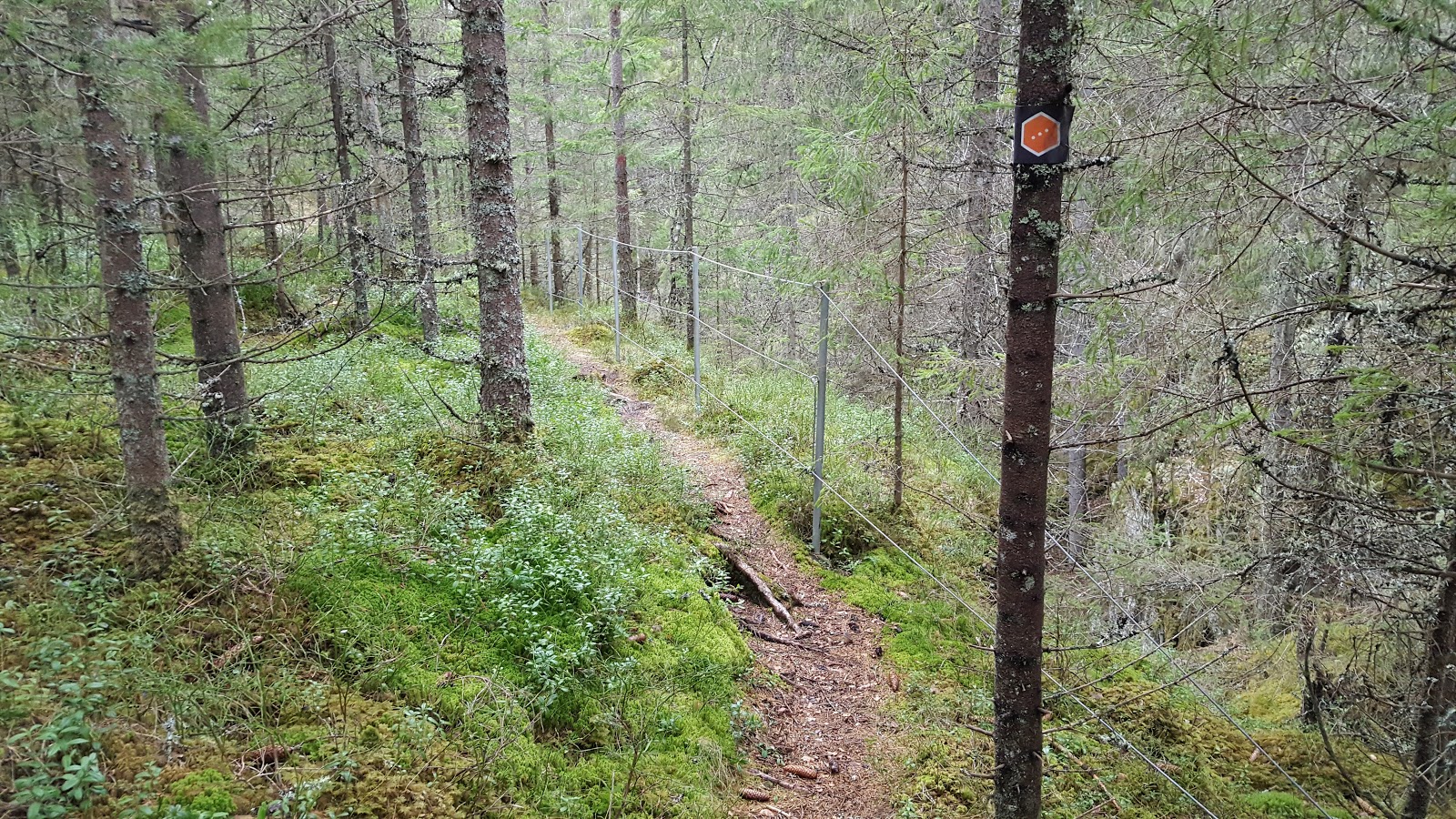
If you want to include this loop as part of your Bohusleden hike, then it is only a few more steps to get you to this loop. The most direct way to do this would be to figure out a way to get to Ed from Bohusleden on your own, be it via bus, train, taxi, or hitch hiking. Or you can hike from the closest point on the trail to the Ed Loop, which is the trailhead at the end/start of stages 22 and 23 at Nornäs.
Here is a link to a less than ideal map of this part of the trail. Below is a picture of exactly the intersection where you can make this connection.
*Update 26/10/2017: I recently put together a map that highlights part of this route, and in full it shows you how to hike across Dalsland from Bohusleden to Pilgrimsleden. You can check out this map here, and this section is part of an alternate E1 hiking trail I came up with called The Troll Trail. You can find out more about The Troll Trail here. *
You can also check out this full map of The Ed Loop that I also put together, which highlights how you would hike it on its own or as a side trail. Keep in mind that in the north after exiting Tresticklands, you would continue to hike east on a dirt road to the small highway where you could hitch a ride, book a shuttle, or catch a rare bus back to the town of Ed.

Take the eastern fork in the road at N. Kornsjön lake, which then goes east into Dals-Ed municipality.
It intersects with the small highway 166, which you can cross right away and follow a trail that follows the highway east.
The trail then ends at the highway after about 1km, but you only have to hike a few hundred meters to a dirt road that goes north.
This dirt road turns into a trail before intersecting with another dirt road, which you then take and hike east again.
Hiking east for about 2km on this road, you will soon see the lake Skottesjön and the road will end--but another trail will begin that goes around the lake to the north.
This short (<1km) trail takes you to a dirt road that you can then follow right to the Heråmaden park.
(Note: This all may sound complicated, but finding and hiking this route was actually quite intuitive and easy for me--though keep in mind I am an experienced backpacker and always have a good map and compass with me. Please download the map I put together to visualize part of this route, which is linked above.)
There is a gravel road that goes north along the edge of Heråmaden park that you can follow for about 5km to a marked trail into the park. Or you could also choose to turn east off this gravel road and away from the park and hike towards Ed, say to resupply and then catch a ride up to Tresticklans park. Going this way is about 10km to Ed.
The gravel road going east ends in the woods, but you can continue to hike east off-trail to the lake St. Klavetjärn, where I recommend you hike around to the north. Shortly after this lake to the east there is a dirt road that you can follow right into Ed. Again, this may sound a bit tricky, but I've hiked this route before on a separate trip, and it went well. And actually there is a good spot for swimming on the small peninsula on the east side of lake St. Klavetjärn. Below is picture of this lake from that other trip.

And that's The Ed Loop and its connection to Bohusleden! I really enjoyed hiking this loop, and will now move on to my trip report, so you can see how my experience played out for me. How I hiked this loop was to begin in Ed, got a ride (via Västtrafik taxi) up to Tresticklans park, hiked south to Bohusleden, and then finished off my trip re-hiking stage 23 of that trail. I will be writing a separate report on that stage in the future to update my Bohusleden guide. But now on with the show!
Trip Report


The trail that goes into the park from the east starts at the end of a gravel road near the hamlet of Rävmarken, north of Ed. There is a small parking lot, an outhouse, and a picnic bench--your typical Swedish rest stop type area. Entering the park it was clear right away that it was well maintained, with good trail markings and well made wooden bridges and walkways. I was given different information by locals in Ed about buses to the park, with one local saying there were daily buses, but online it clearly says you have to call and book a ride to the park (which is what I did).
The Norwegian boarder is only about 4km away from the trailhead, and right across the board there is apparently a cabin for hikers to stay the night. Also in Norway there are other trails that continue on into the woods there, but I chose to turn south at an intersection in the trail just after crossing over the gorgeous, narrow strait of big lake Tresticklan.


Heading south you climb up a ridge and follow it for a while with nice views over the rift valleys. It's a fascinating landscape. For instance it's not everyday you see two lakes next to each other--only separated by around 100m or so--divided by thin stretches of land. You then pass a stunning little peninsula between two hills that provides a complete "moment of zen" package that I highly recommend for a meditative break. The elevation provides a natural wind break on three sides, making it very quiet, save for the sound of a babbling stream that feeds into the lake. If I had more time, I would have loved to have spent more time there.


On my map, there is a symbol for a lookout tower, but talking to locals, I was informed that there was no longer a tower there. It makes the climb up the elevation a bit anti-climactic, as the views are obscured by trees--but the hike itself is quite nice. The forest opens up as the elevation plateaus, and you pass several more lakes, tarns, and marshes heading south on this next rift walk. As I said before, the park is not that big, so if you're an experienced long distance hiker, you'll likely find yourself at the southern end of Tresticklan park. Right after exiting the park is an info sign (see: above) for the next park to hike through!


Now the northern half of Heråmaden park's hiking trail is currently only marked with strips of paper that are used by loggers to mark a section of woods, and they are white and blue. You must be careful and be on the lookout for these faint markers, because the trail is thin and at times pretty much non-existent. But there are signs of maintenance along the way that encouraged me to persist.
Keep in mind that this trail and nature reserve were a complete surprise to me! My original plan was to find an off-trail way to bushwhack and follow roads all the way to Bohusleden. But I was thankful for this great little trail, and it turned out to be quite a lovely hike. The pictures don't do it justice, as there was low light due to it getting to be late. The views on the cliffs overlooking the river that the trail follows were enchanting. Watching the river flow through the marsh set against the rocky cliffs and towering pines sure were something, and I am glad the powers that be created this fine little national park.


Coming down from yet another ridge plateau, you see the Bastedalen cabin. It is marked as an overnight shelter for hikers on the information sign, and is overall a nice little cabin. The good news was that there were three beds, a table, about 30-40m from the front door is a nice little spring with clear water, and outhouse, plenty of supplies and firewood laying around, and one of the single best wood stoves I have ever used--this wood stove and its pipes looked almost brand new. The bad news is that it is in need of a good cleaning, as there were signs of a mouse infestation all over. Two of the beds had holes in them from the mice nesting, and there were mouse droppings here and there all around the cabin.
But it was late and dark out, plus I was tired and saw through the windows that it began to snow outside, so I slept on the one bed that was not messed up by the mice. Before bed I got a nice fire going and enjoyed a great night's sleep. In the morning I was woken up by some day hikers, which I was happy to see, which means that I was not the only one using this trail. I talked to them briefly and they mentioned that from the cabin to the south east side of the park the trail was well marked and maintained, and I would soon see this for myself.
The remainder of the trail has a lot of well made wooden walkways that go over huge patches of marshland, and you exit the park onto the gravel road mentioned earlier that runs north-south. You pass the other gravel road that goes east which can take you back to Ed, or you can continue on until the road turns west and follows a train track, which is what I did to get to Bohusleden.


I didn't take any pictures of the gravel road and train tracks, as they are a pretty straight forward landmark. So once the road comes to the railroad crossing that intersects with another road, cross the tracks and then immediately take the dirt road going west. This road ends close to lake Skottesjön, and there is a trail that connects to another road going west. Going west the road will come to a farm (marked Rinnane on my map), and here is where you can turn onto a trail headed south. From there you'll soon see the 166 highway, and you can choose to follow the highway or find the trail on the north side of the road. Soon there are power lines, and right after those is a gravel road off the highway that goes directly the big lake N. Kornsjön and intersects with Bohusleden.


So there you go, options for a more dynamic and hopefully better hiking experience if you are in the area. I hope this is helpful and that you are able to enjoy this new loop of my own creation as much as I did. Happy trails, and do please feel free to ask questions or give feedback via email--especially if you have hiked this loop.