This is Part 4 of my 6 part series of trail guides for Bergslagsleden. Please read my introduction and epilogue to this trail here if you haven't done so yet. This entire trail is also a part of the E1 trail system, and you can read more about that in my E1 trail guides here. Please keep in mind it is still a work in progress. And you can find the official trail website here if you haven't already.
This report covers stages 7-5, or from Mogetorp to Uskavi/Lindesberg. This will be a unique report in that there I hiked quite a lot of off-trail and/or alternative routes in these stages, perhaps the most dramatic example was skipping stage 6 entirely--more on this later.
The Mogetorp area is on the 50/68 highway and has daily bus connections to the city of Örebro in the south and the town of Nora in the north. There is also a restaurant and hotel near the bus stop. The Uskavi area is somewhat close (~12km) to the town of Lindesberg, and is also close (~2km) to the 50 highway to the east, which has daily bus connections (e.g. Fanthyttan bus stop nearby) going north to the town of Kopparberg or south to Lindesberg if you don't want to hike all the way there. The trail also passes close to the quaint town of Nora, which is on the western shores of the big and aptly named lake Norasjön. Both Nora and Lindesberg offer basic but good resources for hikers, such as cafés, pubs, restaurants, supermarkets, hotels/BBs, public transportation, etc.
Hiking southbound on the E1 you continue on Bergslagsleden, and you can check out my previous guide from stages 11-8 here. Hiking northbound you continue on Bergslagsleden, and you can check out my report on stages 4-3 here.
Now on with the show!
---

After weeks of planning and keeping a close eye on the weather, things did not go as planned for this section hike--but my friend Tomas and I still had a great and very memorable trip. Rather than one day of light snow and two days of clear skies and sun, with low temps going down to around -6C to -8C, instead we got lots and lots of snow, hardly any sun, and low temps only around -3C. When I mean lots of snow, I mean roughly 50cm of snow total--and that's on top of snow and ice that was already there beforehand. It made for an interesting if not difficult set of conditions for hiking through the woods.
I'll need to elaborate more on the conditions before I move on to the details of the trail, because as I noted earlier, we did quite a bit of jumping on and off the trail. In addition to there already being a fair amount of snow, a few days before we arrived in this area it had rained. The rain, rather than melt the snow, created a layer of ice on top of most of the snow. Then add another bunch of snow on top of that, and it makes for an odd sandwich of dry-ish powdery snow, hard ice, and then wetter fresh snow.
In the past when hiking through snowing conditions I've find little difficulty in trekking through roughly 1-20cm of snow, especially when it's very cold out (below -3C or so) and the snow is powdery. For one, going through the woods there are large portions of canopy created by all the trees (especially big pine and fir trees), which limits the amount of snow on the trail. When there is snow and even deep snow drifts up to your waist, so long as you have the right clothing you can just plow through the snow.
It's a bit more challenging, sure. But it's easy compared to this odd sandwich of snow and ice we had to deal with, and this sandwich was ubiquitous on most of the trail. No plowing through that, you are forced to use knee-high stomps to slowly grind through the woods. Many times we were up to our knees, and some of the times in snow drifts up to our asses. There were times we were lucky and could walk on top of packed snow due to someone driving a snowmobile on the trail, but these patches didn't last very long. We both agreed that we wish we had snowshoes or skis, and would look into each of these options for future trips.


Anyhow, after starting our trip and realizing that we were hiking at a pace of 1-2km per hour, and with few precious hours of sunlight, we had to improvise a new route to get to our daily goals. This meant following other trails, lumber roads, roads, streets, and even highways (briefly, thank goodness). But we made it to our goals and got home on time and in the end I am happy with how we were able to deal with a tricky situation. Plus we were still able to experience quite a lot of gorgeous, snow covered woods and frozen lakes. We are both fans of the TV series Game of Thrones (and Tomas has read all the books), and we could not help but compare our setting to that of the woods beyond the wall in the frozen north of Westeros. And like Wildlings or Crows we passed through the desolate, white forests--or at least I enjoyed imagining that we were. No sign of White Walkers... unfortunately.

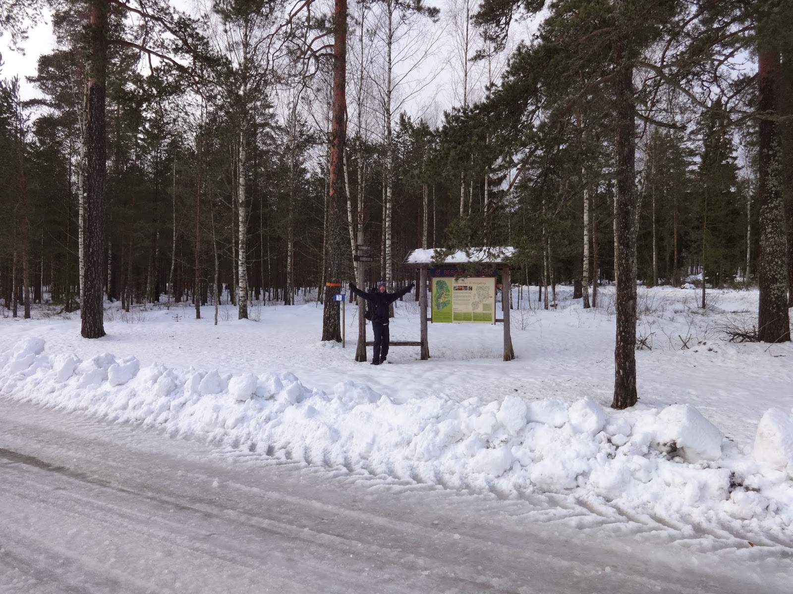
It began by first catching a train to Örebro very early in the morning, and from there a bus to the trailhead right next to Mogetorp. By the time we had hiked to the Ramshyttan nature preserve roughly halfway through stage 7, we had already agreed to follow the road there north to Digerberget (which had packed snow) rather than the trail. The trail runs roughly parallel to this road anyhow, and we got to the Digerberget area just at sundown. This area has a very active ski community in the winter, so look out for people speeding past you on the snow if you are there during prime ski season.
The trail shelter at Digerberget is, well, not really a trail shelter, as it lacks a floor altogether. I would highly recommend sleeping at one of the two shelters to the south on stage 7, or continue on to the trail shelter which is about halfway into stage 6. Or if you want to spoil yourself, just jump off the trail and continue on north to the town of Nora which has lodging. In spite of the poor excuse of a trail shelter at Digerberget, Tomas and I were still able to get shelter and a good night's sleep. It was already getting dark and we were pretty tired from all that thick snow hiking, and decided to make the best of the situation.


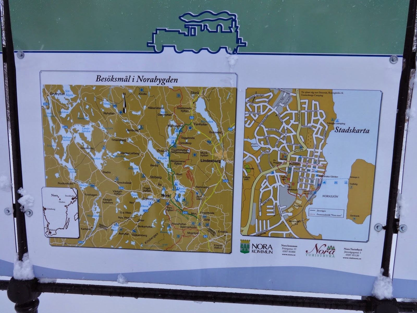
The next day after studying the maps for a while the night before, we decided the best thing to do would be to get off the trail and hike north into Nora. There we could grab a bite to eat and regroup and come up with a plan for the next two stages. We made our way north and eventually got to a highway that goes into Nora, but neither one of us likes hiking on highways of course. Luckily we found a shortcut into Nora. There is an ICA supermarket on the outskirts of town, and behind it there is a pedestrian path that goes right into Nora. It is hard to spot, as you will have to walk all the way behind the supermarket to a small gate in a fence that the path starts at. It was a nice walk into town, and we both agreed that it was worth it going to Nora. It's a pretty little town, plus it had an excellent breakfast buffet at the hotel in the center that we really enjoyed. Nothing like a warm meal and a few cups of strong, hot coffee to recharge.
Studying the maps, we found an alternate route to the trail shelter we had intended on spending the night at in the middle of stage 5. The shelter is on the north-east bank of the St. Gålsjön lake. We debated crossing the frozen lake Norasjön and getting back on the trail again on the eastern side of the lake, but we were not sure if it was safe. So then we realized that we could just hike north to the small village of Born, where there is a lumber road where we could re-join with the trail very close to the trail shelter. Doing this we unfortunately skipped all of stage 6, but considering the conditions, and that a large part of stage 6 goes through wood trails and over a few large hills, we both doubted that we would have either the time or energy to make it to the shelter--not to mention we had a train to catch the next day.
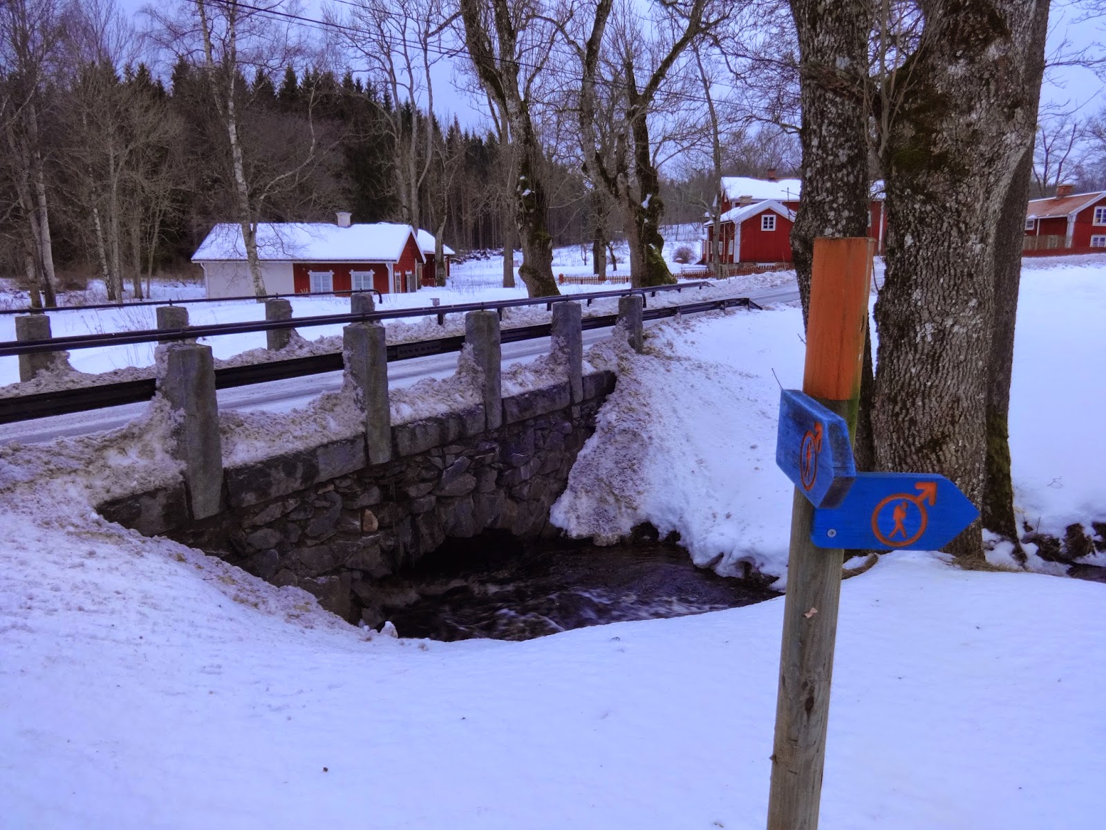
So if you are looking for a quick and easy shortcut back to the trail after visiting Nora, there you go. When you get to the small village of Born don't be confused by the orange trail markings that are there. This is not Bergslagsleden, but another trail for canoeing/kayaking where one can hike over land to the next body of water. Thankfully the trail shelter at St. Gålsjön. Close to the shelter are a few creeks that flow into the lake, and were not frozen over while we were there. Speaking of water, there is water all over these three stages, both wild and tap sources, as is the case with much of Bergslagsleden. So no need to haul too much.


After getting in quite a bit of much needed rest and relaxation at the shelter, the next day we were once again recharged and ready for more snow stomping. Our original plan was to hike to Uskavi and then to the bus stop on the 50 highway that is nearby where we could catch a bus to a train connection. But as before, conditions made this prospect pretty much impossible--not to mention it had snowed steady all night for even more snow everywhere.
So again we studied the map and I remembered that we could connect to our train via the small town Lindesberg to the east. The new plan then was to once again leave the trail, hike on lumber roads first east, then north, then hike east on a paved road that goes pretty much directly into town. From the shelter to central Lindesberg (the bus/train station) it's about 13km, so we were still able to make it to our train on time after catching a bus there back to Örebro.