
At 189km total, Västra Vätterleden is one of the somewhat longer stand alone trails that is a part of the E1 trail system. This report will cover roughly half of this trail, from stages 8 to 5 in their entirety, which goes from the town of Mullsjö in the south to the town of Hjo in the north. The trail goes along the western part of the area surrounding the massive lake Vättern, but doesn't follow the lake directly. There are points where the trail does intersect with this mini-sea of fresh water, such as the end point of this report in the town Hjo, which is directly on the shores of the lake.
In preparing for hike, I quickly found a Swedish website called Skaraborgsleder, with many different maps and reports on trails in the area--including the entire Västra Vätterleden. I printed out and used their maps for this trail and was generally quite pleased with them. You can read/print the maps for yourself here (in PDF format and with info in Swedish):
Stage 8, Mullsjö-Fagerhult
Stage 7, Fagerhult-Semesterbyn
Stage 6, Semesterbyn-Baståsen
Stage 5, Baståsen-Hjo
The E1 trails before this going southbound go from Mullsjö to Ulricehamn, and you can read my report on them here. Going northbound on the E1 you continue on roughly the second half of Västra Vätterleden from Hjo to Karlsborg, and you can read that report here.
If you have not read the introduction to this trail guide yet, you can do so here, and there is also a list of links to other completed reports of the Swedish E1 trails. Please keep in mind this is still a work in progress.
Now on to the guide!
---
 |
| Feeling much better about the E1 on this hike. |
This trail also offers a fair amount of conveinences for backpackers. In general the trail is well marked, and a nice/helpful touch was to see a lot of wooden signs posted along the way. There are several trail shelters, as well as few villages with places to eat, sleep, and stock up in. Then of course there are the two towns at each end of this stage, Mullsjö and Hjo, which have supermarkets, pizza shops, pubs, etc. Water is never really an issue, as there are many lakes, streams, and springs around.
In total this half of the trail is 94km, but there are several ways to extend the hike or to take short cuts. I did both and will explain how and why below. Total I hiked about 91km, and very much enjoyed it in general--though the short swamp crossing wasn't so great. While it is not a hike that offers many stunning views and sights per se, it does offer a lot of more subtle beauty that I really do love, and that I hope my pictures can capture some semblance of.
In the late spring/early summer there are many vast seas of green--lush grasses and shinny blueberry bushes by the thousands! Plus a few not bad views too. There is also a good amount of variety, from open forests to dark troll wood, rocky hills to flat farmland, and more. I will again apologize for my amateurish photography that does not do nature justice, and the past few trips (including this one) I have been more and more annoyed with my camera, which is on its last legs. Sorry for the dust on the lens!
Starting in Mullsjö, I ate a pizza at the same pizza place as I did where I ended my last trip, at Viking Pizza, which is right across from the train station. After that it's quite easy to find the trail, which begins here with stage 8. You can either go south and pick it up at the south end of lake Mullsjön, or walk east then south on a road to where the trail connects (near Nordkärret on the map). I took nearly 400 pictures on this trip, so I will try and let the 80 I chose speak for themselves as much as I can.


 |
| Huge ant hill right on the trail. These stages had a lot of ants! I was very happy that I had my gaiters on. |


The trail soon follows the big lake Hornsjön for a bit, and shortly after there is a lovely trail shelter next to lake S. Kroksjön. There is a parking lot here, so if you are here in the high-season, there is a good chance there will be other people around.
While I was there I had the pleasure of sharing the campsite with a few nice families that were very friendly and welcoming. The man's name in the picture below is Marcus, and we had several nice chats around the campfire along with his family. Good times. I set up my bivy behind the trail shelter, as it was full, and with clear skies it was perfect for cowboy camping. Near the shelter on the other side of the lake is a well made and maintained outhouse.


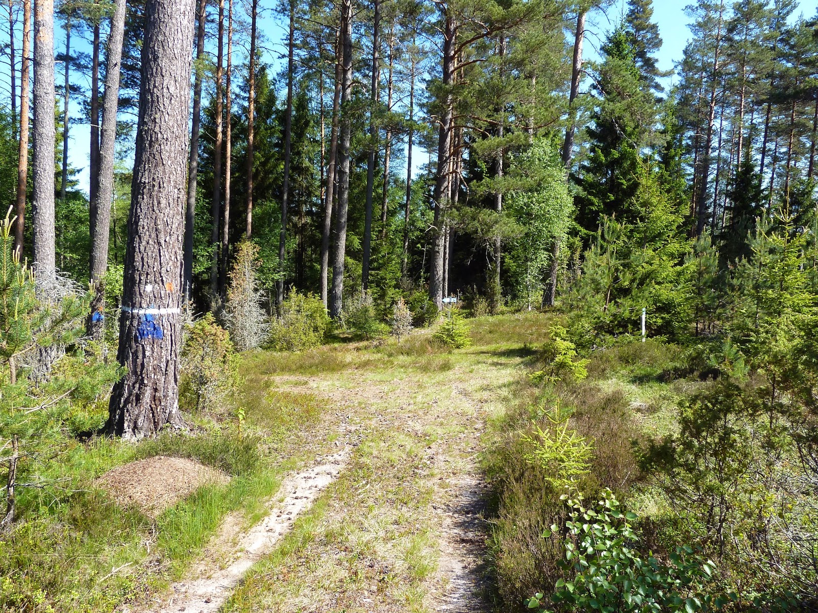
Following the trail soon after the campgrounds near the lake, there is a crossroads where hikers have a few options. You can continue to follow the trail and end up in the village of Fagerhult to the east (where stage 7 official would begin), or you can make a left and go north on another dirt road that eventually turns into another trail. This trail passes through a nature preserve and is marked blue, but eventually re-connects with Västra Vätterleden. It is a small shortcut that saves one about 3-4km, and you also get a longer hike through the nature preserve.
Since I was not very interested in seeing the village (and didn't need any supplies or such), and enjoy more off the beaten path hikes anyhow, this is what I did. I was quite happy with my choice, and even got to see a big moose on the trail, but was too slow with my camera to get a picture unfortunately. Here the path enters Tidaholm municipality and also stage 7 of the trail.


If you need a break, either for a meal or to spend the night, the next part of the trail has several convenient options. There are a few trail shelters as well as a several benches and picnic areas around, and they are all near good sources of water. Passing the lake I saw a fair amount of locals around fishing, taking day hikes, picking flowers, etc., as this area is easy to access by car.
Just a few kilometers from the trail shelter close to the small lake Ibbesjön (the 2nd one you pass in stage 7 going north) there is another small village called Hökensås. This place has a campsite with cottages to rent, a small restaurant, fishing gear, and some supplies. I ended up looping around this village two times due to some confusing markings on the trail. The trail goes right past the village but then loops back south before going east, so I ended up going in a circle. If you want to skip the village, just take one of a few dirt roads that goes north-east just after the trail shelter.
The village also marks the beginning of the next part of the trail, stage 6. It switches from dirt road to trail (mostly trail), and has plenty of hills. I wished it was about a month later when blueberry season is on, because this area is loaded with them.


 |
| Close up view of the stream next to the shelter. |


 |
| The view on top of the boulder. |


Eventually you get to a small nature preserve that has a very nice campsite. There's a trail shelter, outhouse, lake with two small docks, and a trash can. When I got there it was full with a youth scout troop, so I camped out by the lake. After eating and putting my tarp up it started to rain just as I got cozy in my bivy and sleeping bag.
The next day after breaking camp I soon finished the last hilly part of stage 6, where the trail crosses highway 193 and goes into Hjo municipality.


Stage 5 is pretty straight forward, and the trail is more grassy than surrounded/covered by blueberry bushes and lichen like the past few stages. There is a patch of not-so-nice swamp crossing soon after crossing the highway and walk through a few meadows, but it's not the worst swamp I've had to deal with. Though you'll probably be a bit muddy and have a few extra bug bites by the time you've crossed through it. Shortly after the swamp there is one of my favorite little places that I have ever taken a water/snack break at--I was even tempted to stay the night for a split second, but it was much too early in the day to make camp, I thought.
It's called Kärrabo and has a small but excellent spring that the trail crosses right over (about 25m before you get to the clearing), with cold, clear water that tasted good--just like well water, with a slight tinge of a pleasant, metallic aftertaste. There is a really nice little outhouse, a sign with information on the area plus maps, a picnic table, and a nice, flat, grassy clearing (perfect for groups and/or people with big tents).
Past this lovely rest area there is a fair amount of road hiking, but the surroundings are pretty and the path is not as harsh as other roads (i.e. asphalt and large gravel). There is also a bit of troll woods to cross, and I was lucky to find a huge patch of wood sorrel that I happily turned into a large, delicious trail salad. After eating my fill of good, sour greens, I continued on more roads that eventually go back into the outskirts of civilization.


Once you get back to civilization and pass a house on a gravel road (marked Stenbacken on the map), there is again a crossroads that allows for some options. If you make a left and go west, the trail loops around north then east again, and there is a trail shelter marked on the map. If you go to the right and hike east, the road goes towards Hjo more directly. This will save you only about 1-2km in getting to the end of stage 5, and I ended up exploring the area some and found a small trail that re-connected with the E1, and also had some nice views of the area, so probably broke even.
Following the trail to the small highway near the big lake Mullsjön (not to be confused with the town, of course), this pretty much ends stage 5. About 1km north from this point stage 4 begins, and about 3-4km east is central Hjo. In town there are plenty of things to take advantage of like supermarkets, a bus stop, hotels, a hostel, pubs, cafés, restaurants, etc. It's a quaint and scenic little town right on the shores of Vättern. In town I ate a nice fish dinner then got a bus to the small city Skovde, where there is a train station one can connect to. There are trains in Skovde going both west towards Göteborg and east towards Stockholm.
 |
| This is at the crossroads facing left/west, which follows the trail. |
 |
| It was worth it going off trail for this picture alone. |
 |
| But one must be careful going off trail... |


 |
| Central Hjo. |
 |
| Lake Vättern, close to the central Hjo bus stop. |