----------
This post covers Stage 27, Strömstad to Högstad, of the official guide to the trail, from the trailhead in Strömstad to Högstad, and is my starting point and first report of my trail guide.
If you have not already read the introduction to this trail guide, you can check it out by clicking here. It has a list of reports on other sections I have hiked plus other important/useful background information in general--so please read the introduction first before reading my reports.
----------
* Stage 27 marks the beginning of Bohusleden adventure for many backpackers because of the convenient starting location in the town of Strömstad. Travelers often want to visit both Norway and Sweden while backpacking and the town is near the border, or are perhaps coming south from Norway--plus the town has many buses that come in from various places, including the big city to the south (Sweden's 2nd largest city) of Göteborg. Yet the official guide marks this stage as the last one for whatever reason, (in fairness there is an afterthought that it could potentially be the first one), and says little about Strömstad itself.
I began a 5 day section hike of the northern part of the trail in Strömstad on August 13th, 2012. I took the 871 bus from Göteborg, which takes about two hours, and cost 165 SEK. The bus stop in Strömstad is close to the harbor, and there are several cafes and kebab/pizza shops around the harbor. But be careful--kebab is notorious for being of questionable quality. I ate a pork kebab for lunch just before finding the trailhead, and later that night got an upset stomach that I am sure could have only been caused by the kebab :(
But dodgy kebab aside, it's a nice little town, and the trailhead is easy enough to find if you make sure to check a map beforehand. There are several ways to walk to the trailhead from the city center, and it's about 2km. I was excited to hit the trail, and took a more direct route following Karlsgatan east to a bridge, then north on Ringvägen until it curves west to Mellbyvägen where there is a sign for Bohusleden.
 |
| At least the beer was good. |
 |
| The harbor of Strömstad. |
 |
| A view from the Ringvägen bridge on the way to the trailhead. |
 |
| The sign pointing out the trailhead, which is up the road to the right, and past a small group of houses. |
 |
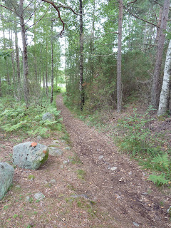
| The beginning of the trail, facing the trailhead. |
It is a nice way to start the trail, is a pretty easy hike all the way through the to the next section, and plenty of natural beauty which includes a big but not very deep cave. You can fill up on water in town, of course, but there are also a few streams along the way.
Important to note on this section is that there is a nice shelter on this section that is not marked or mentioned on the official map/website. Going southbound, the shelter is after you pass the E6 highway and go back into the woods. On the map I am pretty sure it is on in an area marked Hillern. There is a sign that points you towards the shelter on a short, marked trail. It is on top of a hill with a nice view, and has a wood grill. It is not very close to any water, however.
 |
| View from the hill at the unmarked shelter. |
 |
| The shelter itself, facing south-ish I think. |
 |
| Happy about the view and the nice weather, though it doesn't look like it. |
This section ends in some farmland, and took me about five hours walking at a pretty normal pace and taking a few breaks.
For a report on the next section, check out Section 26, Högstad-Krokstrand.
