This is the starting point of the Swedish E1 trails for people heading northbound, as this is where the ferry arrives from Denmark. Or for those that started in Norway and are heading southbound, this is the last section of trail before saying goodbye to Sweden and taking the ferry from the port in Varberg.
This section of trail is mostly the northern third of Hallandsleden, which is divided into two parts. This section is from Varberg to Stättared, and is around 74km total. Here is a map (in PDF) of this section from the official site, and here is the official site for Hallandsleden.
I must admit after printing out and using this map on the trail, that I did not like it. It's proportions are not accurate, there are unnecessary pictures in the way on the actual map itself, and shelters and other useful things for hikers are not clearly marked. I recommend buying a better map of the area, which is what I did for the next section with much better results.
The next section going northbound is the second half of the northern part of Hallandsleden, Stättared to Blåvättnerna (about 40km), and also where this trail ends and the E1 continues on Bohusleden.
If you have not read the introduction to this trail guide yet, you can do so here, and there is also a list of links to other completed trail reports of the Swedish E1 trails. Please keep in mind this is still a work in progress.
Now on to the guide!
---
Varberg is a good place to resupply if needed, but it's not exactly the most exciting city in Sweden. After doing some research on the Varberg area, and following parts of the trail near the city on Google Maps that take you to Hallandsleden, I decided to skip over this first part by taking a bus. If you are like me and not that interested in hiking on streets, residential areas, and past a lot of farmland, you can do the same by taking the 651 bus to Brännhult. From there it is easy to find and connect with the trail, and the terrain goes through more hills and woods from here as well.

Next to the Varberg train station (pictured above) is the bus station, and you can buy a ticket for the bus at the Pressbyrån (convenience store with magazines, snacks, etc.) next to the bus station. It cost me 51 SEK if I remember correctly, and takes about 25 minutes to the rural Brännhult bus stop. Once you get off the bus, cross the road and follow a small farm road north, where you will soon find trail markers. There is also a small stream soon after you get on the trail where you can fill up on water.


Things start off fine as you pass a few lakes, but going by the northern end of the lake L. Neten there were some missing trail markers. I made sure to do a careful search all over the road for trail markers, but could not find any, and was forced to go off-trail in search of the next landmark so that I could get back on track. Lucky for me, quite close to L. Neten are a few small lakes that the trail passes, so soon after finding these other lakes I found the trail again.


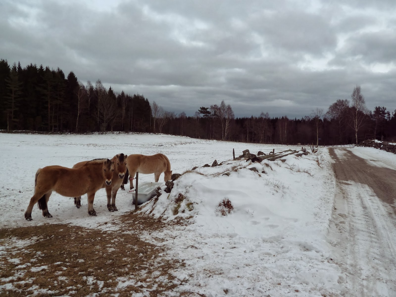
As I mention above in the introduction to this section, the official maps I think could use a lot of improvement. I also noticed that a rest area was not placed on the map in the right location, which should be on the north end of Långasjön rather than the east side of the lake. A small detail, I know, but there are several of these mistakes that I was frustrated by. It's a beautiful area, however, and felt quite isolated and rugged--but perhaps that's because I was there on a cold winter day. The only tracks in the snow around here, and much of the rest of this hike, were animal tracks.


There is some backwoods roads and lumber trails after Långasjön, and then through the more open and broad-leaf forest next to the large lake Stora Neten, which the trail follows for a while.


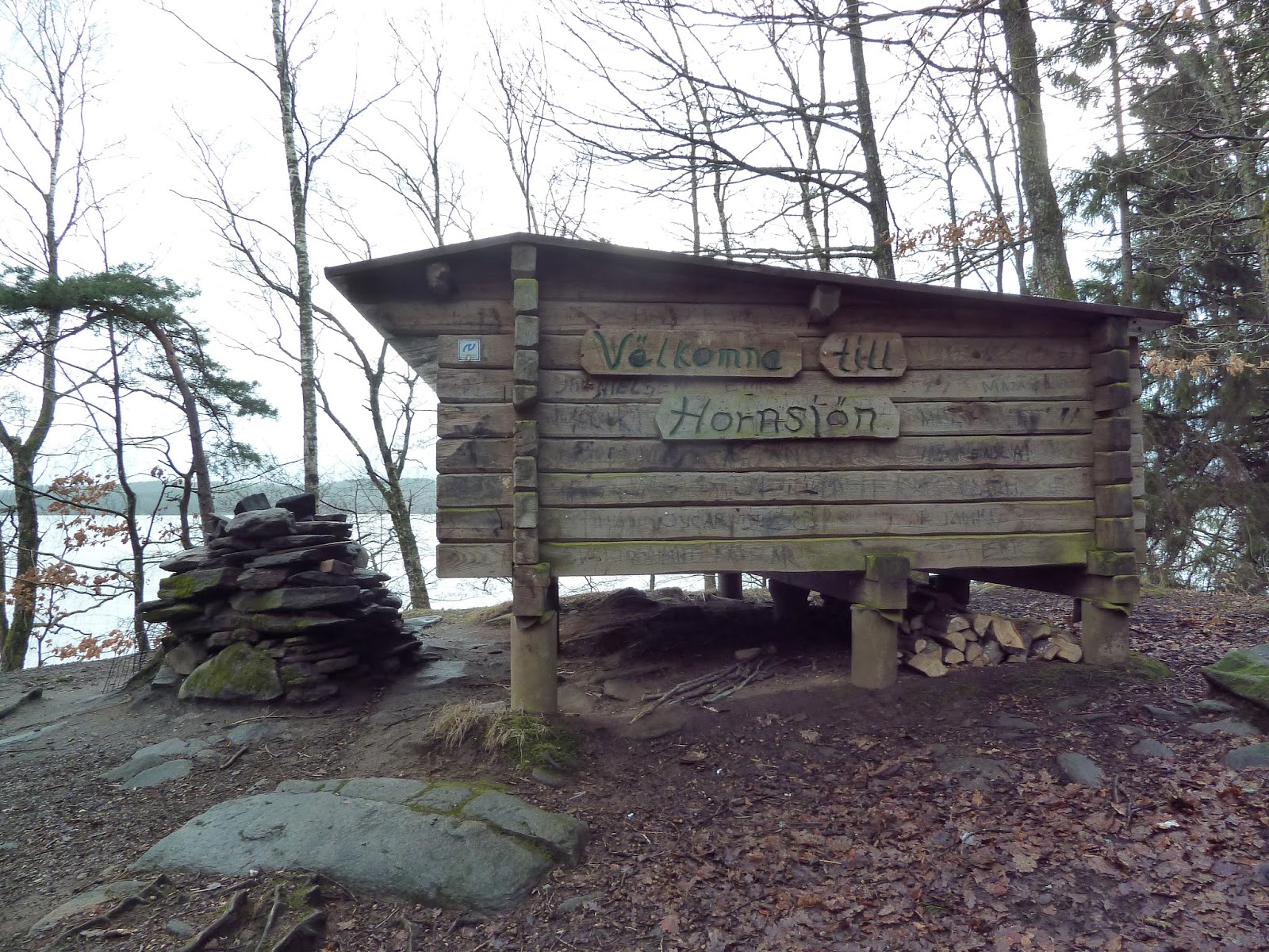
At the northern end of the large lake is a paved road, and shortly there after a parking lot and a smaller lake with a shelter. It's not the best or the worst shelter I've stayed in. It had plenty of firewood and a solid floor, which was nice; but the graffiti and that it was so close to the road that you can hear and see the occasional car drive by all night, I thought was not so nice.
The shelter is quite close to and directly faces the small lake Gällerpesjön, which means more wind due to the cold sink of the lake. Yet I had a good solution for this problem, which was to hang up my tarp on some nails above the door of the shelter, and then put some logs on top of the tarp inside the shelter to keep it from getting blown down or flapping around. Near the shelter by the parking lot is a nice outhouse, and you can wash your hands and fill up on water with the water following under a small bridge close to the outhouse.


After the shelter the trail changes terrain quite a bit. There are tiny, isolated paths through pine troll-woods, larger walkways through open broad-leaf forest, paved roads, dirt roads, past flat farmland, and up and down several hills in the forest. Eventually the trail arrives at a road close to the small town of Veddige to the west. You can follow the road into town, or continue on the trail to the next shelter Dranstugan, the town being a bit further away. I was on my way to town, and a kind old farmer offered me a ride, saying that it was cold, the walk was pretty boring, and that he felt bad for me.
Veddige has a few small restaurants and a coffee shop to get some fast and easy food. To resupply there is supermarket and gas station, plus there is train station. The trail passes through the northern outskirts of town.


I would come back to finish this section on another trip a few weeks later, after all the snow had melted and things were warmer due to spring beginning earlier this year. I got a ride to Dranstugan to check it out, and it's a nice little shelter with good water source right next to it, along with a building that belongs to an outdoors/orientation club. The trail has some strong contrasts shortly after the shelter, as it goes on paved roads by a quarry, over a river, past town, across some train tracks, followed by several small and lovely little waterfalls in some mossy woods. I took a long break next to one of these little water falls and filled up on water, and it tasted as fresh and as clean as most Swedish tap water.


Soon there is a lumber road that takes the trail deep into the woods, where the it passes the lake St. Ärsjön. Soon after this lake is where something strange happened on the trail.

 |
| Little did I know that this less than perfect bridge across the end of the lake would be a foreshadowing of things to come... |
There must have been a storm or some kind of landslide to cause these conditions, which I have to say hiking past this part of the trail was one of the most out of the ordinary and difficult challenges I have faced backpacking in recent memory. What at first appeared like a few trees had fallen over--no big deal, I climb over/under/around fallen trees all the time--turned out to be dozens if not hundreds of tress (and big ones!) that had fallen over right on top of the trail. To call this part "a trail" would not really make much sense, as there was no recognizable trail, really.
And to make matters worse, as you can see in the pictures below, all this took place between two big hills. I could not go around and get on top of the hills on either side of the blocked/destroyed trail, not to mention that it had rained that morning and everything was all wet and slippery. So I was faced with either hiking back and then trying to hike around this obstacle--which could take a long time, and the sun sets fast in the winter in Sweden. So time was an issue, otherwise I would be stuck putting up my shelter back near the lake.
Or I could try and go through the mess of toppled trees and work out another solution, which is what I did. Now more cautious people and/or people with less experience hiking/backpacking/climbing shouldn't attempt something like this. I will admit that my heart did beat a bit faster walking across several tree-bridges, and I gained a new respect for tightrope walkers. Walking across wet tress with random gusts of wind blowing through the small valley in the middle of nowhere has its risks, but I managed to work things out alright. I took my time, was very careful, and got through unscathed and without any falls.
After getting into the middle of the mess I found a way to weave up to a point on the left/west side of the trail, where there was a passable way to climb up on top of the hill. I did this in spite of seeing the trail loop to the right/east, but was happy to see once I got to the top of the hill that further ahead the trail looped back to the northwest and I could skip the rest of this strange wasteland of horizontal tree tightropes. I hope that whoever is in charge of trail maintenance fixes this part of the trail. Either the trail needs to be re-marked and moved to the west on top of the hill to avoid this area, or they are going to need a hell of a lot of work and chainsaws blazing away to clear through the maze of fallen trees.
I intend on sending an email to the people that run the official Hallandsleden site shortly after I publish this section report, and will put any updates on this situation in the future.
*Update 26/02/14: I did indeed not only email the official site, but call someone that is supposedly in charge of the trail maintenance right after I published this report. My email as of now is unanswered and there was no answer at the phone number I was given.


With my adrenalin pumping from dealing with that tricky situation and the sun setting, I made my way towards the next shelter at a fast pace. It was dark by the time I got to large lake Stora Hornsjön, and unfortunately missed out on what looked like some great views of the lake when the sun is up. I was grateful for the many reflective signs up on the trail, which made night hiking much easier.
I was also very grateful for the nice shelter by the lake, which not only was pretty roomy and in good shape, but is also on a small hill rather than right next to the lake, and not directly facing the lake. Far less cold drafts in this shelter, and I got a much needed good nights rest. The peaceful sounds of the small lake waves against the shore was a very pleasant lullaby.


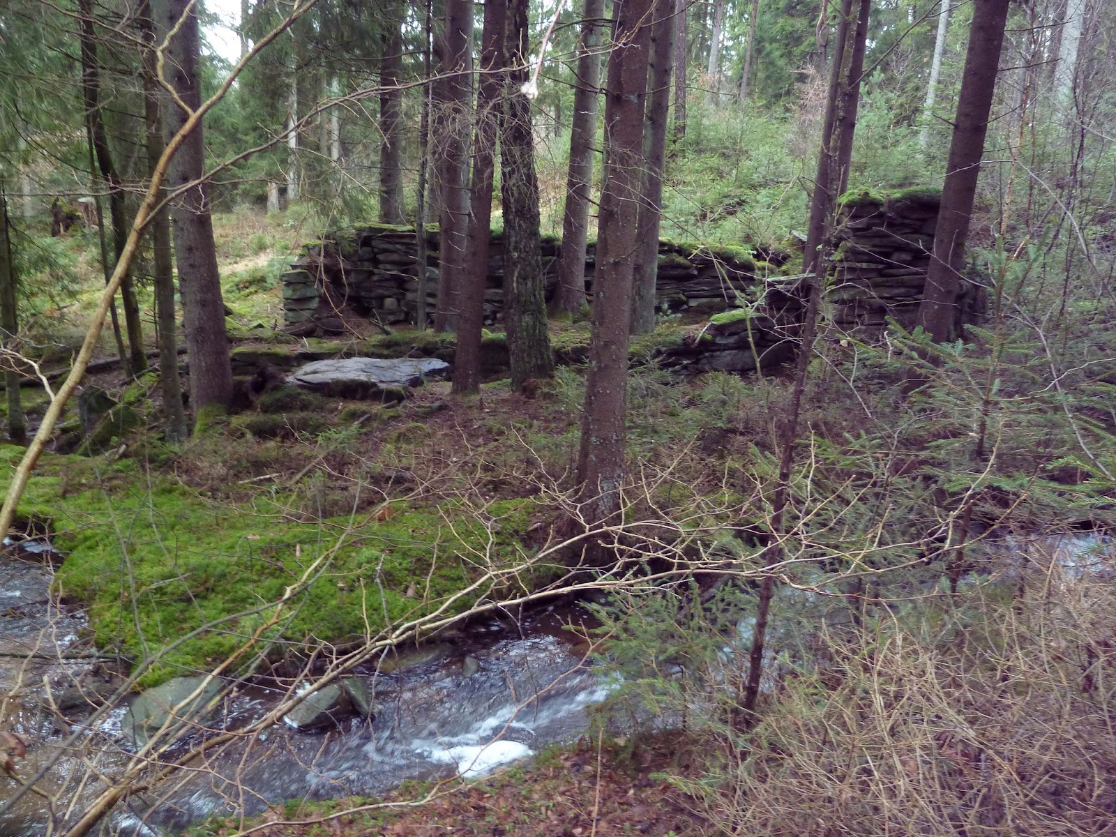
The shelter pretty much marks the end of this section of the E1 trail. Here you are now in Kungsbacka county (the city of the same name is close by), and after the shelter is a short and pleasant hike, passing a few small streams and some ruins, where the trail intersects with a paved road. At this road you can hike west to the bus stop Jönsekullevägen, where you can take the 744 bus into the city of Kungsbacka, but the bus does not run very often and not on weekends. A more solid connection to a bus to Kungsbacka is roughly 23km north in the next section, where the trail passes the suburb of Fjärås. There is always hitchhiking, of course, but as always my obligatory disclaimer to be careful.
Kungsbacka, in spite of being a small city, is quite affluent due to being so close to Göteborg. Plenty of nice and cozy coffee shops. It's a nice place and a good place to resupply, and if you can't find something in Kungsbacka, you can hop on a train and be in downtown Göteborg in about 20 minutes where you can get pretty much anything you want or need. See my report on the next part of Hallandsleden for more advice and recommendations on jumping off and then back on the E1 trails.


Last Updated: 20/03/14