


Introduction
There are several different trails in Scandinavia called "Pilgrimsleden" (The Pilgrim's Trail), so this one is not to be confused with other trails fo the same name! I've hiked on at least two other trails in Sweden called the same, but this guide is for the one that runs through the Dalsland area. The trail goes roughly from the city of Vänersborg in the south to the border of Varmland county to the north. Also worth noting is that past the border to the north, the trail continues and eventually goes into the Glaskogen nature reserve further north, where there are even more hiking trails throughout the park.
Pilgrimsleden Dalsland is about 110km in total, but for the purposes of wilderness backpacking I strongly suggest a modified route. My modified route incorporates a long side-trail that begins in the town of Åmål called Storspåret, and skips a long section from the village of Upperud to Vänersborg on the southern part of the trail. The reason behind skipping this section is simple: it's mostly asphalt walking. And hiking on paved roads for a long time, if you ask me and many others interested in wilderness backpacking, sucks.
But there are also good logistical considerations to my modified route. Rather than starting or ending this trail in the middle of nowhere at the northern endpoint of the trail, one can begin or end in Åmål, which has a train station, buses, supermarkets, restaurants, etc. And in Upperud the trail literally passes by a bus stop (see: below) where you can catch a bus to the town of Mellerud, where there is a train station.

So my way of hiking this trail goes from Upperud in the south to Åmål in the northeast, and covers roughly 75km of trail--55km of Pilgrimsleden Dalsland and 20km of the Storspåret side trail. It's a wonderful section hike that my friends and I really enjoyed.
Here is some more information on Pilgrimsleden Dalsland from its official website.
Here is the official page for Storspåret (in Swedish), that also includes a PDF map of the trail that is not bad.
And finally here is a website with some PDF maps of Pilgrimsleden Dalsland. I discovered these maps after emailing and asking for more information on the trail, and was given this link.
The Trip Report

I have to admit that I had low expectations of this trail before setting off, and was pleasantly surprised by this little gem of a trail. There are several nice views, lots of lakes and streams, plenty of time deep in the woods, and even some relatively newly built and really nice teepee style trail shelters along with some other more traditional lean-to shelters as well. The reason why I was not expecting much was due to a lack of information on the trail. I found a few pictures after some cursory searching, and had to dig around for some maps and info that I linked above. But not much else. It's one of the more obscure trails in Västra Götaland county, and locals (including local hikers/outdoors people) never mentioned the trail to me. I only found out about it after doing some deep dive searching for trails of the area after running out of new trails to explore.
Sometimes life has some nice surprises! I hope to hike this trail again in the future following my route again, and am also very curious to continue north into more trails that lay ahead in the Glaskogen area. Naturally there were some things that could be improved on the trail, which I will point out soon--but overall we had few complaints on our three day hike.
We began by taking the train to Åmål, which is perhaps most famous for the 1998 movie Fucking Åmål. I also recommend the movie, by the way! Walking through town going northwest, the trailhead for Storspåret can be found in a park. One easy way to find the park is to cross a bridge over the E45 highway that leads right to the park. In town if you need supplies, food, or booze, there are places to buy these things along the way.


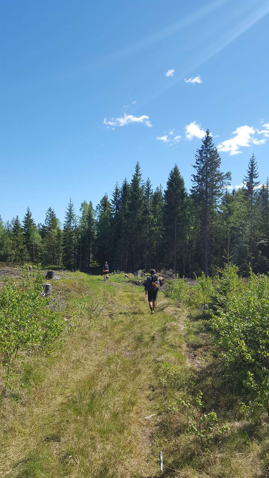
Storspåret starts off as a gravel path and intersects with other local hiking/running trails. Shortly after things get more woodsy, and you pass some lakes and eventually the first cozy, wooden, teepee trail shelter.


Not too long after this shelter through more pleasant forest hiking is yet another campground near a lake. This second camp spot has both a lean-to and a teepee, and we all agreed it would have been a nice spot to stay the night. But it was early yet, so we continued. We also hoped that the shelters to come would be as nice as the ones we had passed, and to our delight we would soon find one that was even nicer. More on that later.


Plenty more woods, but also some hiking on dirt roads, but at least the roads were dirt, gravel, and grass. You pass a few farms, so be aware of farm dogs. Storspåret is only 20km, so if you start the trail early enough, it's relatively easy to finish the entire trail in a day. The trail ends to the west at a ski resort with a ski lift, so you can't miss connecting with Pilgrimsleden Dalsland. Traveling west doing a final bit of road walking, the trail passes over a narrow strait that connects two lakes (Bräcketjärnet and Knarrbysjön). Shortly after the lakes is the big hill where the ski slope is clearly visible.
You can choose to hike around the hill to the north following the trail, or you can choose to hike straight up the ski slope, which is the most direct route to Pilgrimsleden Dalsland going southbound. The views on the hill are great, and on top of the hill just beyond a ski lodge is one of the nicest trail shelters and campsites I've ever stayed at. This campsite has almost everything: great views, a breeze to keep bugs away, another nice teepee shelter with two big windows and a firepit inside, a fire ring outside, a small lean-to near the fire ring, and there are even outhouses behind the ski lodge. The only thing missing was a water source, but you can just fill up at the lakes below on your way (which is what we did).


Heading south down the big hill, there is more pleasant trail to hike that passes by another not bad campsite with a lean-to on the shores of a lake. Continuing past this lake there were signs of beaver activity, and sure enough the trail passes right over a beaver dam. Then for a while there is a mix of woods and lumber roads, but the lumber roads are not bad, being grassy or dirt and easy on the feet. Then there is yet another lean-to that we found even nicer than the last, again on the shore of a lake--this lake (Tansjön) is much bigger and better for swimming, which is what we did to cool off after a lunch break.


After leaving the big lake, there is soon a longer stretch of hiking on a gravel road. You pass a few farms, and there is even an unmarked lean-to trail shelter close to a farm. This bit was perhaps the low point of the trail, but don't worry, as there will be some really great forest treks and nice views to come later on. Crossing a small highway in the tiny hamlet of Ragnerud you may be tempted to take a shortcut around the eastern side of the lake Hålevattnet. At least, we were, because on our maps there was an unmarked trail that shows a path around to the east that connects to the marked trail again. This also would skip a big swamp on the south side of this lake, which we were not too keen to go through, especially with with bug season on the rise.
Well we don't recommend you take this shortcut. We did and regretted it. We found the unmarked trail at first, but it stopped at a dead end and we were forced to bushwhack through thick woods to get to and then around the lake. It took us over an hour to hike a mere two kilometers! So just stick to the marked trail here.
Soon after is the hamlet of Högelund, which had some good and some kinda confusing things about it. The good news is that there was a lookout tower with some great views over the area. There was also a newly built teepee style trail shelter that we found after much searching--but why didn't they built the shelter next to the lookout tower to enjoy the view and make it easy to find? Which brings us to the confusing parts of this place. There are trail markers that went in three different directions, and they are not clearly marked as to where they went. Which ones were side trails and which one was the main trail? If you are looking for the main trail, it's the one that passes the lookout tower and the field the town is in that runs roughly east-west.
However we have reason to believe this is actually an older marked part of the trail, and that they are changing the route of the trail, because later on we found fresh trail markers that lead back to the village as we hiked past the big lake Djup. It seems like the trail in and around Höglund is still a work in progress. There is also no water source that we were able to find in the hamlet, and I even spoke to a local who was kind enough to fill up my water bottles for me. He told me he hasn't found the water source either, and is doesn't know why they put up signs that there is one. My only guess is that the water source the signs are perhaps referring to is a tiny creek that runs through the hamlet and next to the trail shelter. Problem is, while we were there, it had not rained recently and it was a bit dry, so the creek was stagnant and barely trickling.
So careful not to walk in circles in Högelund, forget about the water (there is plenty of water later on), but enjoy the nice views and hiking to the south.


Soon after you pass the big lake Djup, there is another big lake called Flat. On the southeast side of the lake there is a pretty nice campsite that we stayed the night at. It has a lean-to shelter, a fire ring, and easy access to the lake. Careful not to miss the side trail that goes to this campsite, as it could be marked better. Past this lake there is only around 10km left of trail until the Upperud endpoint, and it's actually an excellent bit of trail with a lot of variety packed into such a short stretch. There's dark troll pine woods, open, rocky plateaus, spacious mixed woods (oak, ash, fir), more nice views, and a few more small lakes. There was even another nice teepee trail shelter campsite along the way next to Livarebosjön.
We all really enjoyed this last walk before we caught the bus to go back home, and were satisfied with our choice to skip over the asphalt stomping that remains of the trail going south from Upperud. The Upperud area is also quite pleasant, with a water lock and docks for boats/canoes along with a small park with some benches.


Afterword
As I said before, I expected little but was rewarded with a surprising great little section hike that I think is worth doing again. I hope this guide helps with the lack of information online in regards to this trail, and also hope my alternate route serves others well. I liked this route so much that I am trying to come up with a way to connect it with other trails for a longer thru-hike trail. I can say this for now, that in theory it's possible after taking the bus from Upperud to Mellerud to take another bus to the town of Ed to the west. Ed is actually not so far away (about 42km). And there are also buses from Ed to Åmål as well.
I recently created a way to connect Bohusleden to Ed via The Ed Loop, click the link to check it out. So if there are any ambitious hikers out there looking for an off the beaten-path thru-hike, you could hike Bohusleden, then hike The Ed Loop, then catch a bus from Ed to either Åmål or Mellerud and hike Pilgrimsleden Dalsland. Just an idea!
*Update 05/07/2017: I came up with another hiking route that connects The Ed Loop to this trail, which I call The Dalsland Connection Route. Check it out! This means that you can hike all the way from Bohusleden, to Ed, to the Dalsland Canal area, to Pilgrimsleden, and beyond! *
That wraps up another of my trail guides. As always, feel free to ask questions or give feedback, and happy trails to you.
**Update October 2017: Here is a trail guide to the trails in and around the Edsleskog area (I call it the Edsleskog Loop), which Pilgrimsleden goes through.